Shom’s Historical Archives Made Available in Digital Form
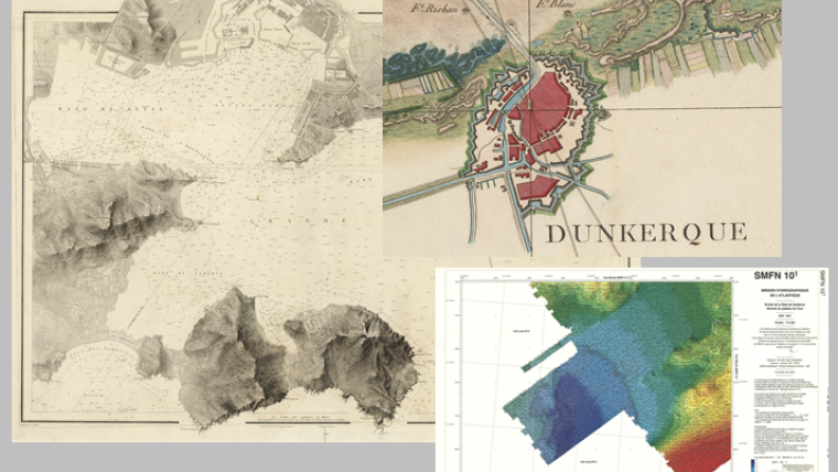
In 2016, as part of the ARCHIPEL project (ARCHIves Patrimoniales En Ligne), Shom digitised 10,000 cartographic documents from all over the world and from its historical maritime and coastal archives. This unusual extract of 300 years of coastal and ocean history consists of approximately 3,300 marine charts, the oldest of which dates back to the late 18th century, and 6,700 hydrographic survey maps ranging from the beginning of the 19th century to the present day.
These documents can be consulted and downloaded free of charge on data.shom.fr and diffusion.shom.fr in the section ARCHIVES MARITIMES. Available as images (JPEG2000 format), they also include metadata (information about documents: date, geographical area, scale, authors ...) facilitating their understanding and use.
Keeping the Heritage Accessible
This work has been carried out within the framework of the Future Investment Projects (PIA - "Digital State Transition and Modernisation of Public Action") launched and co-financed by the General Secretariat for Modernisation Public Action and the Caisse des Depots et Consignation. This is a first but significant step to make the heritage archive of the Shom accessible to the largest number as provided for in its Objectives and Performance Contract.
As in other fields (for example meteorology), this historical heritage covering nearly 300 years opens an important base of knowledge of the past and offers a retreat of several centuries to better understand the major trends and evolutions of coastal and maritime environments. These documents facilitate to better prepare and forecast future evolutions in issues such as climate change, the risks of sea submersion, the evolution of the coastline...
Tip of the Iceberg
These 10,000 digitised documents represent only 10% of the Shom's paper-archived cartographic documents, estimated at about 100,000. To these are added about 40,000 scanning tags (50% work accomplished), about 9,000 books (realised at 5%) as well as several thousand aerial photographs (not started).


