Sound and Light Track Sub-surface Oil
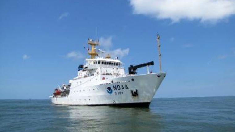
NOAA Ship Thomas Jefferson returned to Galveston, Texas, USA on 11th June from an eight-day research mission to investigate the presence and distribution of sub-surface oil from the Deepwater Horizon/BP oil spill. The mission collected water samples for chemical analysis and tested the feasibility of using acoustic and flourometric scanning to help find potential pockets of subsurface oil clouds. The science team onboard included researchers from NOAA, EPA, the University of New Hampshire and the Woods Hole Oceanographic Institution.
"NOAA is extremely concerned about the health of the Gulf of Mexico and the well-being of the millions of people who depend on these waters for their livelihoods and pleasure," said Jane Lubchenco, Ph.D. under secretary of commerce for oceans and atmosphere and NOAA administrator. "I'm pleased that agency and academic scientists continue to innovate and explore ways to bring the absolute best science to inform the response and recovery efforts."
The use of acoustic and flourometric sensors can help sweep large areas to detect anomalies in the water column. Researchers then deployed water sampling devices in that same area to determine if the anomaly was in fact caused by the presence of oil.
Water samples and the acoustic data are currently being analysed in further detail. Chemical analysis of the water samples is underway to determine if oil is present in the water, in what concentrations, and to identify the source of any oil that is found.
Initial observations from the mission include:
•Scientists observed high fluorescence and reduced dissolved oxygen anomalies at around 1,100 metres depth, 7.5 nautical miles southwest of the wellhead. Laboratory analysis of water samples from this area is underway to help determine if this is an indication of subsurface oil.
•Scientists also observed a subtle acoustic anomaly in the same vicinity. Additional analysis of the acoustic data from both NOAA Ship Thomas Jefferson and NOAA Ship Gordon Gunter will be needed to make further conclusions. Additional field work is also planned to test this method of using acoustic data to locate underwater oil.
•The Moving Vessel Profiler, which allows data to be collected throughout the water column while the vessel was underway, was equipped with a special fluorometer. The fluorometer was tuned to crude oil and was used to collect flourometric data from the surface down to about 100 meters deep in shallower water from Mobile, Alabama to Port Fourchon, Louisana. The samples were taken while the boat was underway, with the instrument moving from the surface to the bottom and back to the surface approximately every 1.5 miles. While there are only limited data to which to compare, the method has been shown to be an effective way to detect water masses with high fluorometry in the coastal zone.
Much of Thomas Jefferson's second mission, currently underway, will be focused on gathering more detailed data in the coastal zone, and collecting supporting data with the conductivity (salinity), temperature and depth (CTD) instrument and water samples to further refine our understanding of potential submerged oil in the coastal zone. Any information on anomalous masses discovered in the coastal zone will be shared with other researchers and emergency responders.
Scientists observed several seeps of what appears to be natural gas in an area of known gas seepage, located to the southwest of the spill site.
Once the water samples from this mission are analyzed, scientists will compare those findings with the acoustic and flourometric data to determine if the imaging data are useful in helping find subsea oil at low concentrations.
"This was a very important mission for us, and we are anxious to get back the final chemical analysis of the water samples we collected. Should this combined method prove effective, it would help researchers more efficiently target their water sampling in future missions in the area," said Dr. Larry Mayer, director of the Center for Coastal and Ocean Mapping Joint Hydrographic Center at University of New Hampshire.
Over the course of the eight-day mission, which began in New Orleans, LA, USA, on 3rd June and ended in Galveston, Texas, on 11th June, scientists collected the following types of data:
•662 nautical miles of acoustic survey data.
•271 "moving vessel profiles" of flourometric data. The moving vessel profiler allows data to be collected throughout the water column while the vessel is underway.
•24 CTD profiles, which measure conductivity (salinity), temperature, depth as well as dissolved oxygen throughout the water column.
•More than 130 discrete water samples at varying depths.
Water samples have been sent to Alpha Labs in Massachussetts, USA, and TDI Brooks in Texas, USA, for further analysis. The full report of the trip is available online.


