Surveying the Waters of Prince William Sound, Alaska
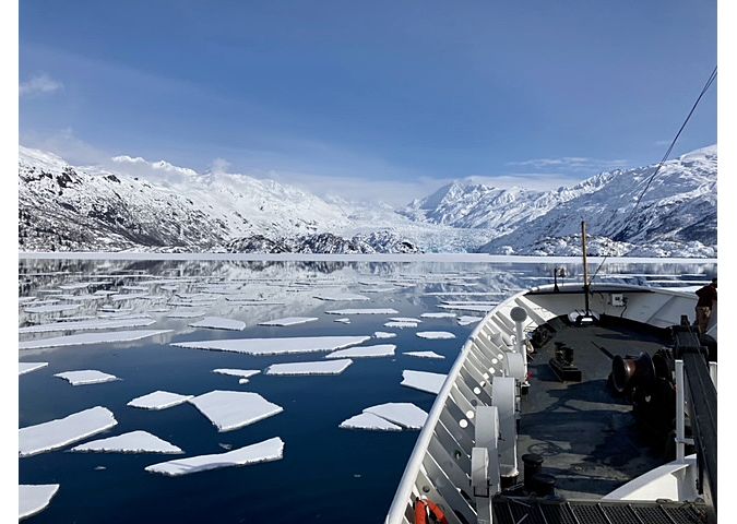
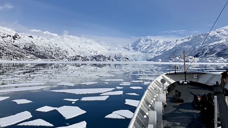
Sheets of ice stretch for miles and miles. Mountains and peaks reach with jagged arms straight for the heavens. Glacier walls and their offspring icebergs bob in the deep, cold water at every turn. The wildlife of the sky and sea come in every shape and size, from Tufted Puffins and Kittlitz’s Murrelets to harbour seals and orcas – this is Prince William Sound.
Prince William Sound is located on Alaska’s southern coast, just southeast of Anchorage. An extensive body of water with an area of about 2,500 square miles, the sound is home to many beautiful islands, wildlife habitats, vast forests, dazzling blue glaciers, indigenous villages and ports. Fishing, the transport of goods and oil and tourism are the sound’s economic bread and butter, all of which deteriorated immensely from 1989 onward due to the Exxon Valdez oil spill in March of that year. Due in part to its remote nature, the sound took many years to clean up and to recover from one of the largest environmental disasters in United States history. Now, decades later, tourism and fishing expeditions have begun to increase. With this increase in potential traffic, depths on nautical charts require higher accuracy to ensure the safety of vessels traversing in and around Alaska’s many natural wonders.
Navigating the Sound – Icebergs, Moraines and More
The NOAA Fairweather and her crew began the journey to Prince William Sound in March 2021, at the beginning of her field season under the new commanding officer Capt. John “Jay” Lomnicky, who relieved Capt. Marc Moser on 9 December 2020. Departing from Seattle, Washington, Fairweather transited the Inside Passage and the Gulf of Alaska for four days to reach Prince William Sound. Upon reaching the survey grounds, the ship’s navigators had to manoeuvre around ice sheets and icebergs to protect her hull and propellers.
To read the full story, see here.