Two Arctic Shipping Routes Ice-free and Open For Passage
Satellite measurements indicate that there will once again be a below-average ice cover in the Arctic this year. As sea ice has melted during the summer months, two major shipping routes have opened in the Arctic Ocean. While the Northern Sea Route above Russia (also known as the Northeast Passage) has been open to shipping traffic since mid-August, recent satellite data show that the most direct course in the Northwest Passage now appears to be navigable too.
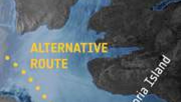
Located in the Canadian Arctic Archipelago, the Northwest Passage can be a shortcut for shipping between Europe and Asia - but with the opening of the sea route comes the potential for both sovereignty claims and marine species migration across the Arctic Ocean.
In 2007, Arctic sea ice hit a record low since satellite measurements began nearly 30 years before. That same year, the historically impassable Northwest Passage opened for the first time. Unusual weather contributed to 2007's record ice loss: skies opened over the central Arctic Ocean and wind patterns pushed warm air into the region, promoting a strong melt.
One year later, satellites saw that the Northwest Passage and the Northern Sea Route were open simultaneously for the first time since satellite measurements began in the 1970s - and now it has happened again.
Every year, the Arctic Ocean experiences the formation and then melting of vast amounts of floating ice, but the rate of overall loss has accelerated. During the last thirty years, satellites observing the Arctic have witnessed reductions in the minimum ice extent at the end of summer from around 8 million sq km in the early 1980s to the historic minimum of less than 4.24 million sq km in 2007.
Before the advent of satellites, obtaining measurements of sea ice was difficult: the Arctic is both inaccessible and prone to long periods of bad weather and extended darkness.
Radars on Earth observation satellites such as ESA's Envisat are particularly suited to monitoring polar regions because they can acquire images through clouds and darkness.
In the coming weeks, ESA will continue to monitor the situation in the Arctic with its Envisat, CryoSat and SMOS satellites.


