World's First Ocean Basemap In ArcGIS
Esri has created and released a new, comprehensive map of the world's oceans and coastal areas. The Ocean Basemap is now available as a cached map service in ArcGIS Online. The first basemap of its kind, the Ocean Basemap is designed to support a variety of maritime GIS applications.
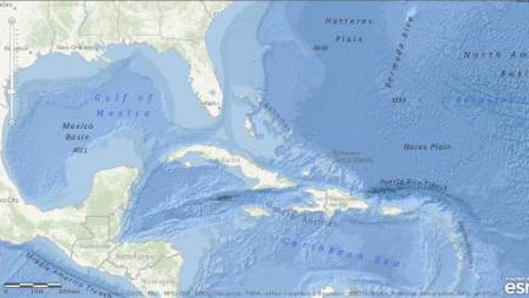
Esri's Ocean Basemap greatly expands the ocean content that's currently available in Esri's online basemaps. Traditional basemaps of the ocean have small scales and only include coarse-grained views of features. The Esri Ocean Basemap includes fine-grained bathymetric and altimetric data from coastal areas, where most of the human activity takes place.
Authored down to a scale of 1:1,000,000, the Ocean Basemap is built using a variety of publicly available authoritative ocean data. For scales from 1:1,000,000 down to 1:36,000, the Ocean Basemap uses the Community Maps model of seeking authoritative user content. Users can contribute data to the Ocean Basemap, just as they add data to any other basemap.
The Ocean Basemap was created with uniform cartography for consistency and a muted colour palette, which makes it ideal for overlaying additional user-specific content or content from ArcGIS Online. Maritime professionals such as hydrographers, port authorities, and coastal zone planners now have a consolidated source of information to access when conducting research and creating their own maps.


