This edition of Hydro International reflects the wide variety of hydrography. It zooms in on hydrography in South America (interview with Admiral Garcez, Director of Hydrography and Navigation of Brazil), marine cartography, satellite-bathymetry, hydrographic depth determination and subsea pipeline inspection. Last but not least, the March/April issue also contains the findings from the annual Hydro International Business Survey.
Stories in this issue:
- Satellite-derived Bathymetry: An Established Surveying Tool for Seafloor Mapping?
- Optimizing a Low-cost Multi Sensor System for Hydrographic Depth Determination
- AUV and ROV Technology Plays Key Role in Historic Discovery
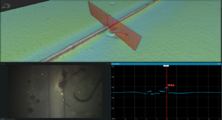
- Advances in High-speed Underwater Remote Vehicles for Subsea Pipeline Inspection
Underwater Remote Vehicles for Subsea Pipeline Inspection
 The pipeline survey industry has undergone a technological revolution in the past couple of years, and the consequential benefits and challenges are only just beginning to be fully realized. Cost efficiency of subsea operations has become been one of the key focus areas of the offshore energy industry in recent years. This focus, combined with increased growth in the amount of subsea infrastructure now in-situ on the seafloor, has seen a rising need for innovative approaches to subsea asset inspection. These solutions need to be cost-efficient, maintain data quality, and be able to provide a platform that supports future technologies. Read on...
Annual Business Survey
 The outcome of this year’s annual survey amongst the readership of Hydro International can be characterized as slightly more pessimistic or, to put it another way, slightly less optimistic than last year. Maybe the best conclusion is that our readers are still very cautious about the outlook in the hydrographic market. All in all, however, the outcomes are largely aligned with last year’s survey results. Read on for more details of the findings. Read on...
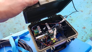
Depth Determination
 With shallow water surveys not required to be performed with the accuracy and precision of industrial projects, surveying devices with lower costs are being welcomed by hobbyists eager to determine water depth. With this low-cost demand rising, the investigative development of these products has become a scientific research issue. The department of Geodesy and Geomatics at HafenCity University (HCU) in Hamburg has been working on cost-efficient solutions in recent years. Read on...
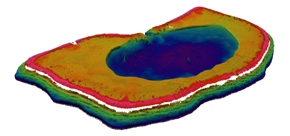
Satellite-derived Bathymetry
 It is only two years since the first hydrographical office started using Satellite-derived Bathymetry (SDB) as a tool to provide high-resolution bathymetry measurements for charting, even independent of other survey methods. These were requested for the recent remote mappings for the LINZ PRNI project. This is a short time period considering it has been over 20 years since the development of the first physics-based approaches, for independent mapping capabilities. Is SDB already really understood, in terms of best practices, requirements, quality assurance processes, limitations and uncertainties for all the variety of conditions that the world's shallow waters offer? Read on...


