Satellite-derived Bathymetry
A study was conducted to evaluate the use of a satellite-derived bathymetry (SDB) procedure to map shallow-water bathymetry in a GIS environment, and to identify areas that require a new...
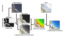
A study was conducted to evaluate the use of a satellite-derived bathymetry (SDB) procedure to map shallow-water bathymetry in a GIS environment, and to identify areas that require a new...
Imagery-derived Bathymetry Validated Dear Sir, I was startled by an article in the January/February 2013 issue entitled ‘Imagery-derived Bathymetry and Seabed Classification Validated’, which took me back to 25 years...
SeaZone has announced the availability of detailed water depth data for seas around the UK. It has taken the company 2 years capturing and processing hydrographic survey data to create...
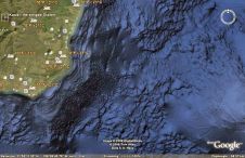
Google Earth now has a better zest of bathymetry. Some people comment that however (importantly) improved, the new ocean floor is not yet true 3D. The ocean floor is...
Global grids of synthetic bathymetry make it a simple matter to portray generalised ocean depths in all parts of the world, except the central Arctic Ocean. Derived from measurements of...
Bathymetric data has traditionally been important for producing nautical charts in support of safe navigation. Hazardous environmental conditions and technological restraints have, however, limited the ability to acquire near-shore data....
GOMaP, the Global Ocean Mapping Project, was a plan to methodically map all the world's oceans by multi-beam sonar. It may be stalled, but swath mapping of the oceans is...
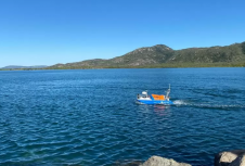
The River Murray Operations Unit (RMOU) of the South Australian Water Corporation surveys very shallow waters, a type of surveying that has its own specific problems overcome by non-conventional solutions....
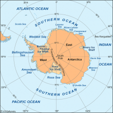
The Scientific Committee on Antarctic Research (SCAR) expert group for the compilation of the new International Bathymetric Chart of the Southern Ocean (IBCSO) proposes to build a consistent bathymetric database...
Unique Group has successfully supported the Australian Institute of Marine Science in completing a carbon-conscious bathymetric survey at Cape Ferguson by performing seabed modelling for their upcoming project, using its...
This site uses cookies. By continuing to use this website, you agree to our Cookies Policy. Agree