NOAA Ship Thomas Jefferson Obtains Cape Cod Bathymetry
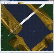
April 2022 marked the beginning of NOAA Ship Thomas Jefferson and her crew’s field season and transit up through the St. Lawrence River, Lake Ontario and into Lake Erie. This...
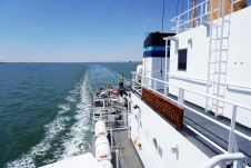
April 2022 marked the beginning of NOAA Ship Thomas Jefferson and her crew’s field season and transit up through the St. Lawrence River, Lake Ontario and into Lake Erie. This...
FarSounder is partnering with The Nippon Foundation-GEBCO Seabed 2030 Project to work together to advance the collective understanding of the ocean floor in pursuit of the complete map of the...
Fugro recently introduced its next-generation coastal mapping system, the Rapid Airborne Multibeam Mapping System (RAMMS 2.0), at the Hydro 2023 conference in Genoa, Italy. RAMMS 2.0, the world’s only airborne...
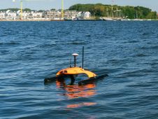
In the realm of advanced robotic solutions and underwater data networks, EvoLogics stands out as a pioneer. Renowned for its uncrewed surface vehicle the Sonobot 5, the company has made...
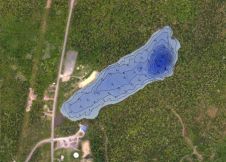
As a geomatics professional and avid kayaker involved in training, consulting and supporting CARIS bathymetric processing software, Matthew Gudger decided to assemble a simple and easy-to-use kayak-mounted bathymetric mapping system...
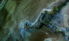
In early 2022, EOMAP started mapping the shallow waters of Belize using SDB technology. Parts of these approximately 9,000 square kilometres had never been sufficiently surveyed before. Now, the bathymetry...
Accurate bathymetric mapping of shallow areas is essential for many offshore activities. Through Structure from Motion (SfM) and Multiview Stereo (MVS) techniques, images can provide a low-cost alternative compared to Lidar...
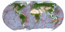
On 11th January 2012, Google replaced its global bathymetry SRTM30_PLUS V4.0 with the newer version V7.0. This has increased the area of seafloor covered at 1km resolution from 10% to...
The single beam echosounder has come a long way. First developed in the early 20th century in response to the RMS Titanic disaster of 1912, early models used a Fessenden oscillator...
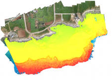
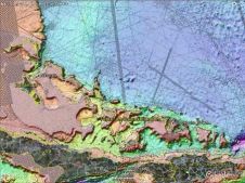
The Norwegian Hydrographic Service (NHS) has and will be utilising airborne LIDAR bathymetry in connection with the ongoing effort to modernise the maritime infrastructure along the Norwegian coast. This article...
This site uses cookies. By continuing to use this website, you agree to our Cookies Policy. Agree