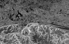
Mapping the seafloor with remote sensing and satellite imagery
While 70% of the Earth is covered by water, very little of it has been surveyed so far (Mars, Venus and the Moon are better surveyed). The techniques for doing so...
While 70% of the Earth is covered by water, very little of it has been surveyed so far (Mars, Venus and the Moon are better surveyed). The techniques for doing so...
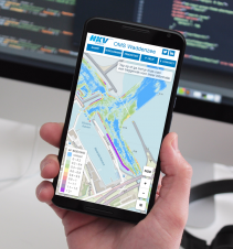
The navigation channels in the Dutch Wadden Sea require continuous maintenance due to unceasing sedimentation of sand and mud. This article describes the data management workflow and adopted technologies for...

3D at Depth, an expert in subsea Lidar laser technology, has officially launched its subsea survey support services to help clients realise additional value from their underwater 3D data. The...
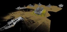
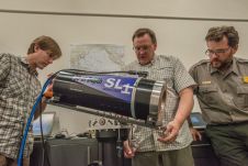
3D at Depth, a global provider of advanced subsea Lidar (SL) systems and survey support services, has completed its 300th subsea Lidar spool metrology. The subsea Lidar measurement, conducted offshore...
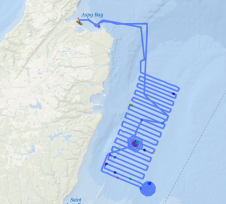
OceanAlpha’s autonomous bathymetric survey boat, the ME40 for hydrographic survey, has been applied in the mining industry for tailing dam surveys, in addition to its common application in lakes, rivers,...
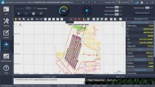
3D at Depth, a global provider of advanced subsea Lidar systems and solutions, has partnered with iQ3Connect to deliver a new data visualisation tool to help clients build, maintain, map...
Coastal communities around the globe are seeking better ways to understand and manage regional ecosystems. They depend on the ocean to sustain economic opportunities, ensure food security and safeguard fragile...
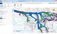
The Port of Hamburg is the third-largest container port in Europe and among the biggest in the world. There are almost 300 berths with a total of 43 kilometres of quay servicing...
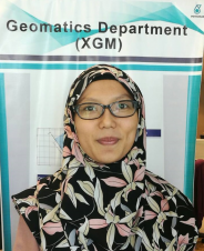
Sr (Surveyor) Fariza Muhamad Faiz graduated from the University of Technology Mara (UiTM) in 2006 with an honours degree in Surveying Science and Geomatics, with a Vice Chancellor Award. After...
The IOGP Geomatics Committee’s Seabed Survey Data Model (SSDM) Task Force has completed SSDM version 2 incorporating industry feedback received since the release of SSDM version 1 in April 2011....
This site uses cookies. By continuing to use this website, you agree to our Cookies Policy. Agree