The evolution of Dutch hydrography
Given the Netherlands’ geographical location, it is unsurprising to find it has a long tradition of hydrography. The lowland, often below sea level, forms a delta where major rivers from...

Given the Netherlands’ geographical location, it is unsurprising to find it has a long tradition of hydrography. The lowland, often below sea level, forms a delta where major rivers from...

Fujitsu has presented a pioneering technology that harnesses Lidar and AI to capture high-resolution 3D data of organisms, coral reefs and man-made structures such as offshore wind turbines using autonomous...

VideoRay, a leading manufacturer of portable underwater robots, has announced the launch of its new vehicle called Ally. Ally is the newest member of the Mission Specialist family, joining the...

By harnessing capabilities of advanced satellite technology and ever-evolving data analysis, satellite-based mapping (including satellite-derived bathymetry, SDB) offers an efficient, extensible and cost-effective method for mapping water properties, underwater topography...
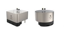
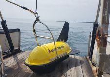
The MS400U is a compact Multibeam Echosounder (MBES) specially designed for USVs or other unmanned platforms. It has a built-in sound velocity sensor and IMU & GNSS, which are the...
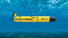
Teledyne Webb Research, a leading innovator in oceanographic research, has launched the Slocum Sentinel Glider, poised to make its debut at Oceanology International (Oi) in London in March 2024. The...
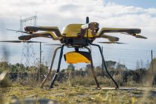
YellowScan, a familiar name in the mapping and land surveying realm, is making a noteworthy entrance in the hydrographic sector with the introduction of its pioneering UAV-based bathymetric Lidar solution....
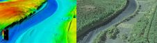
The US Geological Survey (USGS) and Dewberry have jointly released a new topobathymetric Lidar dataset for the Potomac River, extending from the Potomac Highlands in West Virginia to the Chesapeake...
EdgeTech, a leader in high-resolution sonar imaging systems and underwater technology, has increased the standard depth rating to 3,000 metres on all new 2050 combined tri-frequency sidescan sonar and high-resolution...
C-Nav, USA, has launched its improved five-centimetre C-NavC2 GNSS subscription service. C-NavC2 supports GPS and GLONASS corrections and delivers the real-time Precise Point Positioning solutions around the world. The service...
This site uses cookies. By continuing to use this website, you agree to our Cookies Policy. Agree