Landing on the abyssal plain
Electrification and the transition to a green economy are rapidly accelerating the demand for metals and rare earth minerals. As this demand cannot be met by recycling existing metals, a...
Electrification and the transition to a green economy are rapidly accelerating the demand for metals and rare earth minerals. As this demand cannot be met by recycling existing metals, a...
Since the 1970s, remote sensing has increasingly been used to conduct underwater surveys. Several methodologies are employed in hydrographic surveying, from direct techniques such as probing rods to more sophisticated...

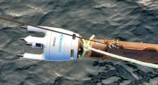
Family-run subsea acoustics experts Applied Acoustics recently launched a new acoustic positioning offering, which is their first combined Inertial Navigation (INS) and Ultra Short Base Line (USBL) system. The Pyxis...
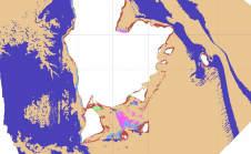
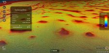
Aside from being able to monitor water depths, the most recent multibeam echosounder sonar (MBES) systems can also simultaneously record the reflected intensities from different seafloor surfaces. With this capability,...
Seaforth Geosurveys, a leading Canadian marine survey company, recently acquired iXblue’s new Gaps M5 USBL system to support data acquisition for marine geophysical survey projects. These include one in the...
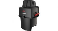
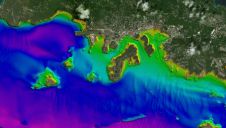
Leica Geosystems, part of Hexagon, has announced the introduction of Leica Chiroptera-5, the new high-performance airborne bathymetric Lidar sensor for coastal and inland water surveys. This latest mapping technology increases...
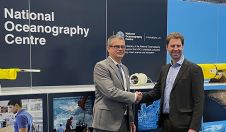
Teledyne Marine and the National Oceanography Centre (NOC) have opened the doors of the new NOC Glider Service Centre; a joint partnership created for the servicing, support and repair of Teledyne...
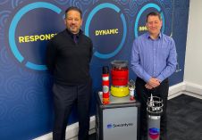
Subsea Technology and Rentals (STR), a multidisciplinary technology expert specializing in the design, production, rental and sale of innovative marine survey equipment, has committed to a multi-million-pound investment in seafloor,...
TCarta Marine, the Colorado-based provider of hydrospatial products, will present its satellite-derived bathymetric (SDB) data sets on Terradepth’s Absolute Ocean visualization platform for the first time at GEOINT 2022. Additional...
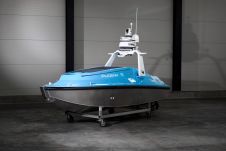
Aquatic Drones, based in the Netherlands, recently introduced the Phoenix 5 Autonomous Surface Vessel (ASV). The unit, with a length of five metres, provides a stable platform for a range...
This site uses cookies. By continuing to use this website, you agree to our Cookies Policy. Agree