Prince Albert II of Monaco opens 3rd IHO Assembly
The 3rd Session of the Assembly of the International Hydrographic Organization opened on Tuesday in Monaco. More than 400 registered delegates from 81 Member States started a week of deliberating...
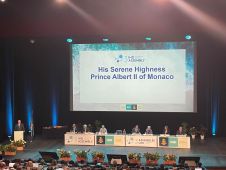
The 3rd Session of the Assembly of the International Hydrographic Organization opened on Tuesday in Monaco. More than 400 registered delegates from 81 Member States started a week of deliberating...
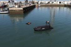
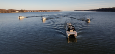
The hydrographic institute of the Spanish Navy, Instituto Hidrográfico de la Marina (IHM), has received three unmanned autonomous vehicles (USVs) from Norwegian company Maritime Robotics. Equipped with advanced sensor technology,...
The implementation of the new IHO hydrographic geospatial standard for marine data and information, the S-100 product family, presents significant challenges that require coordination between the IHO, the industry involved...
Teledyne Geospatial will bring its latest advancements in ocean mapping hardware and software solutions to Ocean Business 2023, being held at the National Oceanography Centre, Southampton, UK from April 18-20....
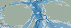
The Denmark Depth Model (DDM) is a digital bathymetric model covering Denmark’s exclusive economic zone (EEZ). It was developed based on hundreds of bathymetric survey datasets and historical sources and...
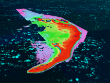
GEOMOD is a software development company specialized in marine geomatics and hydrography. Since 2004, we have been building our expertise on hydrographic products dedicated to mariners, harbour workers, and hydrographic...
Cartographers working in hydrographic offices and ENC editors have the responsibility of processing bathymetry datasets to generate ENCs compliant with the S-57 IHO standard. This is a time-consuming and fastidious task that requires a specific set of skills and knowledge. Nowadays, this expertise is challenged by the constant progress being made in data acquisition techniques and equipment, which has led to a significant increase in the number and size of bathymetry datasets. To face these challenges, the CARTONAUT project was launched by Shom cartographers in collaboration with GEOMOD marine geomatics engineers, both located in Brest, France. The project led to the creation of CALHYPSO, an automated solution for the generalization of bathymetry datasets for S-57 ENC production. This article reports the development of CALHYPSO through the CARTONAUT project and provides details about the tool’s concept and features. Cartographers working in hydrographic offices and ENC editors have the responsibility of processing bathymetry datasets to generate ENCs compliant with the S-57 IHO standard. This is a time-consuming and fastidious...
Woolpert has been awarded a contract by the National Oceanic and Atmospheric Association (NOAA) to conduct hydrographic surveying and collect bathymetric data in the Chesapeake Bay Watershed. The project, funded...

The impacts of climate change and sea-level rise on daily life in Kiribati and the Pacific region can also be felt in the hydrographic profession. In this interview, Tion Uriam,...
TCarta Marine, a global provider of hydrospatial products and services, is expanding its involvement in the Seabed 2030 project. The initiative aims to map the entire ocean floor by 2030,...
This site uses cookies. By continuing to use this website, you agree to our Cookies Policy. Agree