New Order for Paper Chart Masters
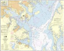
IIC has been awarded a contract from Land Information New Zealand (LINZ) for the production of 50 paper chart masters using Citrix technology and CARIS HPD. The production work...
IIC has been awarded a contract from Land Information New Zealand (LINZ) for the production of 50 paper chart masters using Citrix technology and CARIS HPD. The production work...
The National Oceanic and Atmospheric Administration (NOAA, USA) has implemented a new nautical charting system based on Esri GIS technology to produce more navigational products than ever before without increasing...
NOAA's development of a new navigational chart processing system moved to initial limited production on 21st September 2011. The new system, which slims down the current map production process while...
Under its five-year Indefinite Delivery Indefinite Quantity (IDIQ) contract with US National Oceanic and Atmospheric Administration (NOAA), Fugro Pelagos Inc. commenced surveying operations around the Aleutian chain's Krenitzin Islands, Alaska...

An understanding of the interplay between glaciers and the ocean is needed to improve sea-level rise projections. Seafloor mapping is critical in this pursuit, particularly where the ice sheets of...
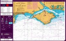
Meridian Chartware are pleased to announce that they will shortly be relaunching the UKHO chart plotter as a Meridian product called ‘EasyCharts’. The UKHO/RYA electronic chart plotter which was developed...
Jeppesen has donated a classroom supply of its C-MAP OceanView office chart and route planning systems to the Merchant Marine Academy of Makedonia (AEN Makedonias) in Greece. The academy is...
The position of bathymetric sensors in hydrographic education is beyond discussion, as bathymetry is, was and will continue to be the bread and butter of the hydrographic surveyor. Bathymetric sensors...
L-3 Nautronix has released Electronic Navigation Chart (ENC) Analyzer Software Version 2.8. The software, which is used to produce, manage and distribute electronic navigation charts and paper charts, advances the...
Short-sea dry cargo specialist Arklow Shipping is increasing its use of ECDIS in step with a major fleet expansion programme. Company marine superintendent Dave Elliot says that cost savings of...
This site uses cookies. By continuing to use this website, you agree to our Cookies Policy. Agree