The evolution of Dutch hydrography
Given the Netherlands’ geographical location, it is unsurprising to find it has a long tradition of hydrography. The lowland, often below sea level, forms a delta where major rivers from...

Given the Netherlands’ geographical location, it is unsurprising to find it has a long tradition of hydrography. The lowland, often below sea level, forms a delta where major rivers from...

Between January 2023 and February 2024, TDI-Brooks, a specialized company in geotechnical and offshore survey projects, conducted an extensive site investigation programme across two offshore wind blocks in state and...

Geospatial cloud specialist north.io has announced it aims to revolutionize the modelling, collection and processing of ocean data using NVIDIA technologies. According to Jann Wendt, CEO, north.io, the synergy between...

Corey Goodrich is a majority owner and managing partner of TCarta, a small Denver, CO-based business specializing in satellite-based innovative technologies for improved modelling and understanding of shallow water and...

By harnessing capabilities of advanced satellite technology and ever-evolving data analysis, satellite-based mapping (including satellite-derived bathymetry, SDB) offers an efficient, extensible and cost-effective method for mapping water properties, underwater topography...

In an era of great power competition, unmanned maritime systems (UMSs) have begun to take centre stage and are now on an accelerated development path for reasons that are clear....
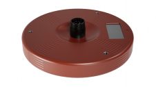
Kongsberg Discovery, a leading player in oceanographic instrumentation, has introduced a new product innovation to the ADCP market, blending “flexibility, simplicity and high-resolution performance.” Unveiled at Oceanology International, the CP333...
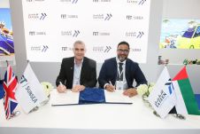
Forum Energy Technologies (FET) has announced that its Subsea Technologies product line executed a memorandum of understanding with an underwater inspections provider, Safeen Survey & Subsea Services, to collaborate on...

The coastal zone is immensely important for humankind, marine and coastal spatial planning is a vital tool for planning and preserving the world’s coasts. Ron Furness, is a nautical cartographer,...
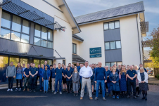
Teledyne Technologies has entered into an agreement to acquire Valeport Holdings Limited and its affiliates (“Valeport”). Established as a dynamic company in 1969 and headquartered in Totnes, United Kingdom, Valeport...
This site uses cookies. By continuing to use this website, you agree to our Cookies Policy. Agree