EMODnet Bathymetry New Release
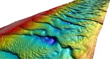
A new version of the EMODnet Digital Bathymetry (DTM) has recently been published which now covers all of Europe's seas. The resolution of the EMODnet DTM has been increased from...
A new version of the EMODnet Digital Bathymetry (DTM) has recently been published which now covers all of Europe's seas. The resolution of the EMODnet DTM has been increased from...
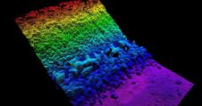
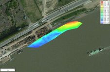
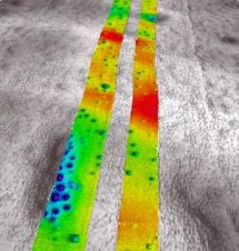
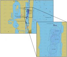
Released to selected trial customers earlier this year, the next-generation software for Kongsberg Maritime’s GeoSwath Plus shallow-water multibeam echosounder has already been put through its paces on the River Douro...

For some years now EMODnet has been creating access to marine data sources. The long-term aim of EMODnet is to unlock the wealth of marine observations and data in Europe...
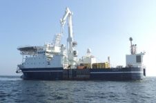
MMT, Sweden, has been awarded the SK4 & NorNed protection survey contract by Statnett, Norway. The aim of the offshore survey is to provide Statnett with a Terrain Model (DTM)...
Eye4Software, The Netherlands, has announced that the latest version of its hydrographic survey package, Hydromagic version 5.2, has been released to the public. The main purpose of this software is...
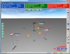
The recent release of QPS QINSy (8.10.2013.10.10.1) includes real-time functionality for using advanced catenary tools to compute the tow cables and anchor chains involved in a rig move using a...
RESON is providing a SeaBat 7125 sonar system for a new breakwater mapping system GEOSUB 3DTM developed by the company MESURIS in France. It is a high-resolution 3D real-time bathymetric...
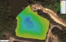
Eye4Software’s hydrographic survey package, Hydromagic version 5.1, has been released. The software maps the bottom of a river, pond or ocean in 3D by using a (D)GPS or RTK positioning...
Designing offshore engineering facilities requires large amounts of information. To acquire it, suites of engineering and geophysical surveys are run, which as a rule include such techniques of seabed and...
In the last few decades, substantial efforts have been made to improve and facilitate the way hydrographic data is obtained. One technology is the EdgeTech 4600, an interferometric phase difference...
This site uses cookies. By continuing to use this website, you agree to our Cookies Policy. Agree