The Siboga Expedition
The Indonesian archipelago is one of the world’s most beautiful archipelagos. Home to over 17,000 islands, mountains rising to over 5,000 metres, including over 70 historically active volcanoes, fabled spices,...

The Indonesian archipelago is one of the world’s most beautiful archipelagos. Home to over 17,000 islands, mountains rising to over 5,000 metres, including over 70 historically active volcanoes, fabled spices,...
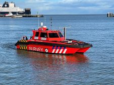
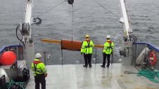
Nicola Offshore, a new company specializing in turnkey services for the most challenging marine survey campaigns and on-demand missions in and around Europe started operations from its headquarters in Hamburg...
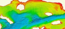
EMODnet Bathymetry, an initiative of the European Commission, has announced on behalf of the full consortium with all associated collaborators the release of the latest version of the EMODnet Bathymetry...
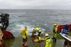
Subsea Europe Services (Hamburg, Germany) and Cyprus Subsea Consulting and Services (Nicosia, Cyprus) have entered into a new strategic cooperation to share knowledge and services that will simplify the acquisition...
The 32km-long Afsluitdijk, completed in the Netherlands in 1932, transformed the Zuiderzee – once a shallow bay of the North Sea – into the freshwater IJsselmeer, named after the River...
While nautical charting mainly focuses on bathymetry and objects that form a hazard to shipping, offshore construction and dredging require sub-bottom information. There is nothing worse in any project than...
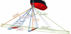
Although the single beam echosounder is still in use, it has over the last 25 years gradually been replaced with new and less expensive multibeam echosounder (MBES) systems. And, although...
Fugro Marinestar, provider of a range of GNSS positioning services worldwide tailored for the dredging and marine construction, navy and hydrographic, wind farm and oceanographic research sectors, has become official...
Bo Krogh, senior surveyor, has more than 35 years’ experience in hydrographic, engineering, environmental and archaeological survey projects, including offshore construction surveys, seabed mapping surveys, marine archaeology surveys with AUVs,...
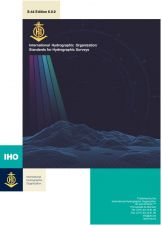
The IHO has recently released a new edition of the Standards for Hydrographic Surveys (S-44). In addition to surveys to support the safety of navigation, these standards can be adapted...
This site uses cookies. By continuing to use this website, you agree to our Cookies Policy. Agree