Introducing the Denmark Depth Model
The Denmark Depth Model (DDM) is a digital bathymetric model covering Denmark’s exclusive economic zone (EEZ). It was developed based on hundreds of bathymetric survey datasets and historical sources and...
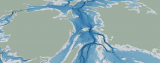
The Denmark Depth Model (DDM) is a digital bathymetric model covering Denmark’s exclusive economic zone (EEZ). It was developed based on hundreds of bathymetric survey datasets and historical sources and...
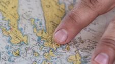
Cartographers working in hydrographic offices and ENC editors have the responsibility of processing bathymetry datasets to generate ENCs compliant with the S-57 IHO standard. This is a time-consuming and fastidious task that requires a specific set of skills and knowledge. Nowadays, this expertise is challenged by the constant progress being made in data acquisition techniques and equipment, which has led to a significant increase in the number and size of bathymetry datasets. To face these challenges, the CARTONAUT project was launched by Shom cartographers in collaboration with GEOMOD marine geomatics engineers, both located in Brest, France. The project led to the creation of CALHYPSO, an automated solution for the generalization of bathymetry datasets for S-57 ENC production. This article reports the development of CALHYPSO through the CARTONAUT project and provides details about the tool’s concept and features. Cartographers working in hydrographic offices and ENC editors have the responsibility of processing bathymetry datasets to generate ENCs compliant with the S-57 IHO standard. This is a time-consuming and fastidious...
A team of researchers from the University of New Hampshire recently made a groundbreaking discovery in Lake Huron. They were part of a world-renowned team that found an intact shipwreck...
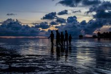
The impacts of climate change and sea-level rise on daily life in Kiribati and the Pacific region can also be felt in the hydrographic profession. In this interview, Tion Uriam,...
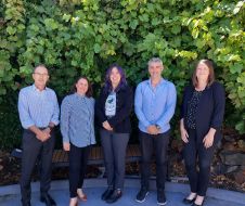
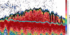
The Blue Economy Cooperative Research Centre (BE CRC) has entered into a new partnership with Echoview Software, the industry-leading hydroacoustic data processing science and software experts. Established in 2019, BE...
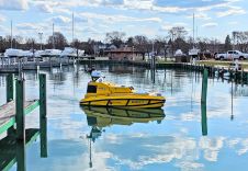
Rough conditions at sea can result in lost cargo, man overboard or even the sinking of vessels. The Netherlands Coastguard, supported by the Royal Netherlands Sea Rescue Institution (KNRM), the...
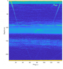
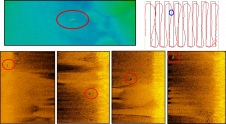
ASL Environmental Sciences has announced successful field trials of a new prototype split-beam sonar, which were conducted in the Saanich Inlet near the Institute of Ocean Sciences (IOS), Sidney, BC....

Over the years, hydrography has experienced several revolutions, both in terms of technology and standards, which culminated in November 2022 in the IMO adopting a Resolution on Performance Standards for...
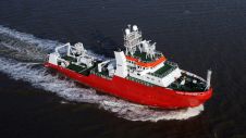
The Norwegian Petroleum Directorate (NPD) has awarded contracts to the companies Fugro and Enviros for mapping of the shallowest strata under the seabed. The objective is to locate sites that...
Echoview Software has released Echoview 13, the latest update to the powerful hydroacoustic data processing software for water column research in both marine and freshwater environments. This latest release was...
This site uses cookies. By continuing to use this website, you agree to our Cookies Policy. Agree