N-Sea secures Geo Ranger for long-term subsea operations
The N-Sea Group has formalized an agreement with Geo Plus for the long-term charter of the Dutch-flagged vessel the Geo Ranger, a cutting-edge hybrid survey and ROV support vessel. This...
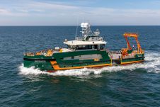
The N-Sea Group has formalized an agreement with Geo Plus for the long-term charter of the Dutch-flagged vessel the Geo Ranger, a cutting-edge hybrid survey and ROV support vessel. This...

How do you perceive prospects in the hydrographic surveying industry in 2024, compared to the past couple of years? When contemplating the hydrographic sector holistically, which areas of investment do...

Through the collaborative implementation of satellite-derived bathymetry (SDB), the Danish Geodata Agency and EOMAP are synergizing efforts to contribute to the European Marine Observation and Data Network (EMODnet) Bathymetry partnership....
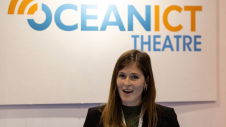
The co-located expo within Oceanology International 2024 has been expanded to bring together the most influential AI, communications, satellite, IT and IoT stakeholders. OceanICT, the only UK event focused on...
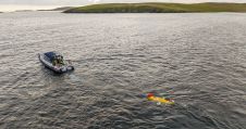
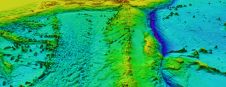
The National Oceanography Centre (NOC), working with the University of Southampton and the Department for Environment, Food and Rural Affairs (Defra), recently completed a Fully Autonomous Marine Protected Area Seafloor...
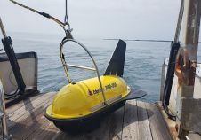
Combining the DriX uncrewed surface vehicle (USV) and the FlipiX remotely operated towed vehicle (ROTV), Exail has developed a unique solution enabling fully autonomous and remotely operated surveys. Combining the DriX uncrewed surface vehicle (USV) and the FlipiX remotely operated towed vehicle (ROTV), Exail has developed a unique solution enabling fully autonomous and remotely operated surveys. Accurate surveys...
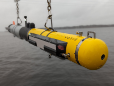
L3Harris, Voyis and Wavefront have joined forces to introduce cutting-edge technology aimed at enhancing the autonomous underwater vehicle (AUV) capabilities of the NATO Navy. L3Harris specializes in the development of...

Various attempts have recently been made to expand the scope of research in the maritime field through the convergence of cutting-edge technologies. One example is the remote classification and prediction...
ARGANS, a leading Earth observation company, has contributed a significant dataset of 8,000 square kilometres to The Nippon Foundation-GEBCO Seabed 2030 Project – the project seeking to inspire the complete...
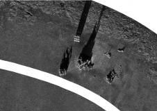
EdgeTech, a leader in high-resolution sonar imaging systems and underwater technology, has increased the standard depth rating to 3,000 metres on all new 2050 combined tri-frequency sidescan sonar and high-resolution...
This site uses cookies. By continuing to use this website, you agree to our Cookies Policy. Agree