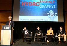
What Is ‘Hydrospatial’?
In the last decades, we have progressed from ‘graphic’ to ‘digital’ and now to ‘spatial’. During the opening plenary session of the Canadian Hydrographic Conference (CHC) 2020, the author gave...
In the last decades, we have progressed from ‘graphic’ to ‘digital’ and now to ‘spatial’. During the opening plenary session of the Canadian Hydrographic Conference (CHC) 2020, the author gave...
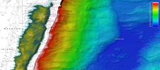
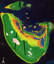
Australian scientists have for the first time mapped in high resolution the seafloor location of MV Nella Dan, a polar resupply ship that was sunk near Macquarie Island nearly 33...
Every spring in the Northern hemisphere, the ocean surface erupts in a massive bloom of phytoplankton. Like plants, these single-celled floating organisms use photosynthesis to turn light into energy, consuming...
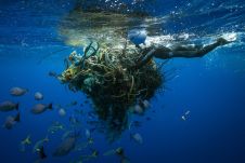
An estimated 600,000 tons of abandoned fishing gear ends up in the oceans every year. According to the United Nations, some 380,000 marine mammals are killed each year, either by ingesting this fishing gear or being caught in it. Mary T. Crowly of the Ocean Voyages Institute describes how GPS trackers are being used to mark the ghost nets. An estimated 600,000 tons of abandoned fishing gear ends up in the oceans every year. According to the United Nations, some 380,000 marine mammals are killed each year, either by...

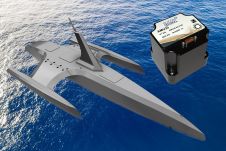
In response to calls from the scientific community, ports and industrial surveyors, Chartwell Marine, a pioneer in next-generation vessel design, has announced the launch of its Scanwell shallow draft survey...

Salem Masry, an icon in the hydrographic world, died on 1 February. This was announced by his close relatives earlier this week. Salem passed away surrounded by his family after a long...

The Australasian Hydrographic Society (AHS) has announced that applications are now being received for the Society’s 2020 Education Award. The $3,500AUD award is provided to a student whose study - in...

Two researchers present evidence in the journal Proceedings of the National Academy of Sciences, a peer-reviewed multidisciplinary scientific journal that publishes original research, scientific reviews, commentaries, and letters, that the accelerating melt...
TCarta Marine, a provider of marine geospatial products, is commercializing a new technique to derive highly accurate shallow-water bathymetry measurements from NASA’s ICESat-2 satellite data. The new methodology is being...
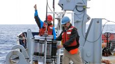
Two Silicon Sensing Systems ultra-precise AMU30 inertial measurement units (IMUs) will provide critical navigation data to the autopilot capability for the Mayflower Autonomous Ship (MAS) throughout her milestone transatlantic voyage...
This site uses cookies. By continuing to use this website, you agree to our Cookies Policy. Agree