Hydrospatial and the marine environment
Hydrographic offices (HOs) today exist in a world of accelerating technological change that is influencing human behaviour and creating new needs for and ways of exploiting data to understand our...
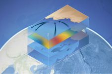
Hydrographic offices (HOs) today exist in a world of accelerating technological change that is influencing human behaviour and creating new needs for and ways of exploiting data to understand our...
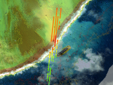
TCarta Marine has announced the development of new machine learning-based bathymetric mapping technologies – including the creation of two software packages and the commercial application of NASA’s ICESat-2 satellite –...

Dawn Wright joined Esri as chief scientist in October 2011. Previously, she spent 17 years at Oregon State University as a professor of geography and oceanography, where she maintains an affiliated...
“It wasn’t always easy being a black woman in my early days as an oceanographer,” says Dawn Wright, chief scientist at a worldwide operating company specialized in mapping and spatial...
Ever since I was a young boy, I've always known what I wanted to be: a journalist. It has never been anything else, at least not for longer than a...

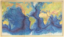
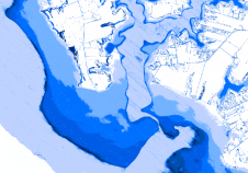
Denmark has challenging seascapes to map and chart. It has a rich history of nautical charting that dates back to the seventeenth century, and many of its navigational products for...
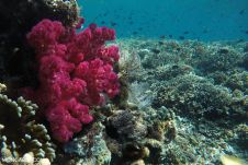
The ocean is increasingly becoming too hot to handle and coral reefs are suffering as a result, according to a recent publication on Mongabay, a website with news and inspiration...

XPRIZE, a global leader in designing and operating incentive competitions to solve humanity’s grand challenges, has announced winners in the US$7M Shell Ocean Discovery XPRIZE, a global competition to advance...
The remarkable capabilities of airborne Lidar continue to improve, with scanners now able to emit more than a million pulses every second. Although it has never been easier to acquire...

Esri has announced that Argentina's coast guard, Prefectura Naval, and Aeroterra S.A. have partnered to implement Esri's ArcGIS platform for a real-time tracking system. The new system, called Guardacostas Pro,...
This site uses cookies. By continuing to use this website, you agree to our Cookies Policy. Agree