Found 174 results
Sort by

Esri

Esri® helps organisations map and model our world. Esri's GIS technology enables the organisations to effectively analyse and manage their geographic information and make better decisions. They are supported by an experienced and knowledgeable staff and an extensive network...


Read more

QPS Bundles Esri Technology

Quality Positioning Services (QPS, The Netherlands) has signed an original equipment manufacturer (OEM) agreement with Esri, USA, to bundle its QINSy and Fledermaus products with Esri software and provide a...

Read more

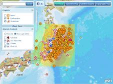
Esri Supports Japan Response

In response to the devastating Japan earthquake and tsunami, Esri (USA) is providing assistance to a myriad of organisations involved in the disaster response. The company is working closely with...

Read more

New ESRI Charting Solution

ESRI has introduced its new Production Line Tool Set (PLTS) Nautical Charting Solution, which includes data loading, single-click editing, extraction and quality control production tools, as well as a product-specific...

Read more

Esri Joins World Ocean Council

Esri has joined the ocean business alliance, World Ocean Council (WOC), and will support its international initiatives for sustainable development and conservation of the ocean. Esri chief scientist Dawn Wright...

Read more