AUV Sea Trials and Tribulations
In 1999, the oil companies BP, Amoco, and Shell jointly published a document detailing the industry requirement for a survey AUV (Autonomous Underwater Vehicle) that stated: "For industry to adopt...
In 1999, the oil companies BP, Amoco, and Shell jointly published a document detailing the industry requirement for a survey AUV (Autonomous Underwater Vehicle) that stated: "For industry to adopt...
On 12 August 2002 IXSEA and OCEANO Technologies successfully completed their merger previously announced in March 2002, revolutionising the landscape of the positioning industry. With 100 staff and over 25...
Terratec is introducing software capable of accurate positioning based on post-processing of GPS-observations, without the use of reference stations or DGPS services. Typical accuracy for kinematic applications are 3cm horizontally...
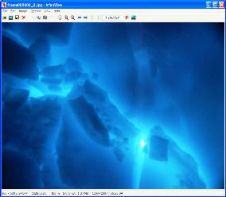
The Gavia AUV has returned from its latest trip to the Arctic circle, where it carried a GeoSwath wide swath sonar, collecting bathymetry and side scan data from the underside...
News On Friday 16th April 2004 the Hydrographic Society held a workshop in Zierikzee, sponsored by Noordhoek. The theme of the afternoon meeting was ‘ROV support for underwater construction’ and...
IXSEA won the 'Amber Medallion' in the Rear Admiral Xawery Czernicki Grand Prix at Balt-Military-Expo 2006 in Gdansk, Poland in early June for MARINS inertial navigation system. Designed to meet...
The Island of Bonaire in the Southwest Caribbean, a Marine Protected Area since 1979, has one of the most pristine coral reefs in the region. The last synoptic survey of...
The 8th annual International Lidar Mapping Forum (ILMF) held in Denver (CO, USA) from 21 to 22 February 2008 turned out to be the best ever. With over 580 registered...
News The Hydrographic Society of Benelux held a workshop at Ixsea Oceano bv in Haarlem, The Netherlands on 11 June 2003. Seventy people from the dredging and offshore industries, survey,...
Currently, the precision of sub-sea global positioning (of UUV and ROV) in deep water is considered to be lagging behind the precision and functionality of GPS-based surface positioning offshore. This...
This site uses cookies. By continuing to use this website, you agree to our Cookies Policy. Agree