Navigating the rising tide
Experts are extremely concerned about the temperature of the Pacific Ocean, as the sea surface temperature this year was the warmest since satellite measurements began. This can have major consequences: for...
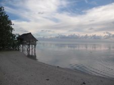
Experts are extremely concerned about the temperature of the Pacific Ocean, as the sea surface temperature this year was the warmest since satellite measurements began. This can have major consequences: for...
From 23 October to 24 November, Hydro International will bring bathymetric sensor technology into the spotlight during the Bathymetric Sensor Weeks. These themed weeks will feature a dedicated weekly newsletter...

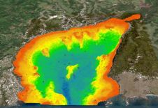
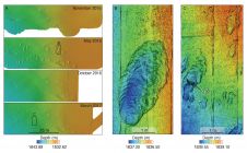
Fugro has been chosen by the Florida Department of Environmental Protection (FDEP) to map the Atlantic coastal waters of Florida, stretching from Georgia to Miami. The contract was granted as...
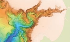
A deep understanding of seabed topography and coastal features is crucial for developing predictive models to address challenges such as coastal inundation and rising sea levels. Communities worldwide rely on...
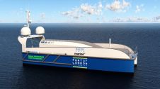
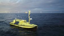
SEA-KIT International has won funding from the Zero Emissions Vessels and Infrastructure (ZEVI) competition to design and manufacture a hydrogen-fuelled uncrewed surface vessel (USV). The company will partner with maritime...
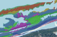
Cutting-edge technology has been utilized to survey Monterey Canyon’s seafloor by a research team comprising members from MBARI, USGS, Durham University, the University of Hull and Pontificia Universidad Católica de...
This article presents a novel methodological approach to understand and assess the suitability of airborne Lidar bathymetry for the automatic classification and mapping of the seabed. This solution allows recording of...
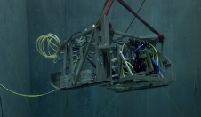
In a bid to uncover the secrets of the deep seafloor, the Monterey Bay Aquarium Research Institute (MBARI) has joined forces with 3D at Depth, a leading expert in commercial...
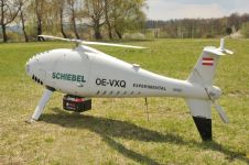
RIEGL Laser Measurement Systems and Schiebel have successfully completed the integration of a high-end laser scanning system, the RIEGL VQ-840-G topobathymetric Lidar sensor, on the Schiebel Camcopter S-100 uncrewed aerial...
Ørsted, one of the world’s foremost offshore wind farm developers, has designed and developed an uncrewed surface vessel (USV) specifically for offshore metocean measurement campaigns. The collected measurement data plays...
This site uses cookies. By continuing to use this website, you agree to our Cookies Policy. Agree