Found 631 results
Sort by

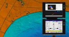
Acoustically Aided INS and Lidar

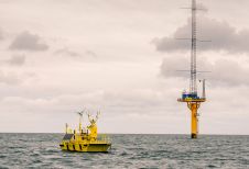
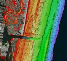
Aerial mobile mapping using Lidar and GNSS-aided inertial navigation has revolutionised the efficiency of land and shallow-water bathymetric surveying. Now, fast ultra‑high resolution subsea mobile mapping is approaching. Millimetre-resolution Lidar...

Read more

Commercial Acceptance of Floating LiDAR

AXYS Technologies (Canada) has recently completed another two successful validation campaigns for its FLiDAR 6M wind assessment platform. This latest achievement marks the 9th and 10th independently reviewed offshore validations...

Read more

Award for Hydrographic Lidar Scanner

On 15 May 2013, RIEGL won the Geospatial World Award in the category Geospatial Technology Innovation Surveying at the Geospatial World Forum Conference in Rotterdam, The Netherlands, for the RIEGL...

Read more