The Crown Estate Commissions Latest Marine Aggregates Data
The Crown Estate recently commissioned new detailed survey work to enhance knowledge of the quality and distribution of marine sand and gravel resources in the UK and to support the...
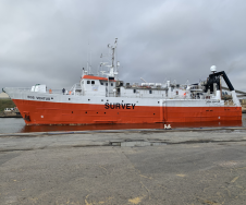
The Crown Estate recently commissioned new detailed survey work to enhance knowledge of the quality and distribution of marine sand and gravel resources in the UK and to support the...
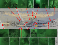
Seafloor pipelines are a critical infrastructure for oil and gas transport. Timely inspection is required to verify their integrity and determine the need for maintenance, as failures in these pipes...

In this interview, Harald Sternberg, Professor of Hydrography and Geodesy at HafenCity University, shares his thoughts on the key market trends, technology drivers and challenges, and the impacts of COVID-19...
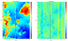
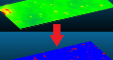
Pedro Menandro is PhD candidate (MBES multispectral backscatter data for seabed classification) in Oceanography at Universidade Federal do Espírito Santo (Brazil). Currently works on habitat mapping using different datasets, exploring...
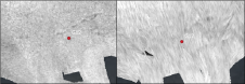
The key objective was to make a rapid and accurate determination of the source of the diesel and oil that had appeared on the ocean’s surface. The company carried out hydrographic survey work using a Norbit Winghead i77h multibeam echosounder (MBES) system. An oil slick was seen on the surface of Nootka Sound and staining on rocks of nearby Bligh Island, west of Vancouver Island, Canada, in late 2020. This set in...
Countless ships and aircraft were lost at sea in the two world wars. Many of these went down with a large amount of fuel and munitions onboard, not to forget...
While online data acquisition is of course of the utmost importance in hydrography, technological developments mean that modern surveyors also need to know about data science, machine learning and artificial...
The British Antarctic Survey (BAS), a world-leading centre for polar science and operations, has added the iXblue DriX Uncrewed Surface Vessel (USV) to its advanced robotic survey means. Deployed from...
The multibeam echosounder (MBES) is used for various purposes, and MBES systems have become the standard instrument for bathymetric determination. However, new developments mean that MBES systems are no longer...
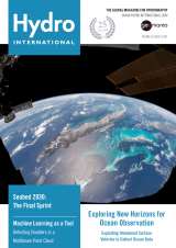
Clouds trace out the islands of the Caribbean Sea in this photo taken by an astronaut from the International Space Station. Beyond the solar arrays and the docked Progress resupply vehicle, the multitoned waters of the Caribbean and the Atlantic Ocean frame the Bahamas, Cuba, Jamaica and southern Florida. Clouds trace out the islands of the Caribbean Sea in this photo taken by an astronaut from the International Space Station. Beyond the solar arrays and the docked Progress resupply...
This site uses cookies. By continuing to use this website, you agree to our Cookies Policy. Agree