Subsea Success for NASNet
Nautronix has completed the first field-wide deployment of NASNet by Subsea 7, in the Agbami field, offshore Nigeria. The field is operated by Star Deep Water Petroleum Limited (an affiliate...
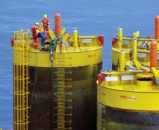
Nautronix has completed the first field-wide deployment of NASNet by Subsea 7, in the Agbami field, offshore Nigeria. The field is operated by Star Deep Water Petroleum Limited (an affiliate...
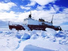
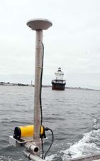
Applanix' POS MV position and orientation system technology will be working with nautical sensors aboard the U.S. Coast Guard icebreaker Healy, which left port in early August 2007 to map...
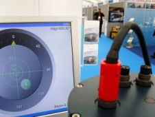
Sonardyne International has launched a new marine Attitude Heading and Reference System (AHRS): Lodestar. Lodestar has been developed to overcome the problems associated with conventional sensor platforms. The Lodestar AHRS...

The DG14 RTK offers high-precision in a low-cost GNSS unit. The DG14 RTK from Magellan is a sub-meter GNSS (GPS + SBAS) and Beacon receiver. DG14 RTK was developed to...
Odom Hydrographic Systems has presented the ES3-M, a portable, beam-forming multi-beam that incorporates the best features of products from two industry leaders in one compact package. The result of...
Kongsberg Seatex, the position reference systems division of Kongsberg Maritime celebrated a significant achievement in the development of its Motion Reference Unit (MRU) today (March 11th 2008) by presenting Subsea...
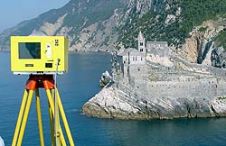
When surveying the coastline, the integration of bathymetric (below sea level) and laser scanning (above sea level) data causes problems due to the different imaging properties. However, by ensuring that...
When accelerometer-based heave units were developed, there were limited options for verifying their performance at sea with a recognised standard. With real-time kinematic (RTK) global positioning system (GPS) devices, surveyors...
Many hydrographers consider the Combined Uncertainty and Bathymetry Estimator (CUBE) algorithm a useful aid in processing bathymetric data and ‘measuring’ survey quality. This paper discusses extending the use of CUBE...

One of the fastest emerging trends in hydrographic surveying is the use of the vertical component of RTK GPS to determine real-time water level corrections. There are currently several district...
This site uses cookies. By continuing to use this website, you agree to our Cookies Policy. Agree