TrueOcean unveils smart hydrospatial data search tool
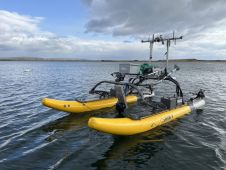
The TrueOcean Marine Data Platform (MDP) has recently seen the addition of a new geospatial search function that enables data on the platform to be located and accessed in seconds...
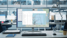
The TrueOcean Marine Data Platform (MDP) has recently seen the addition of a new geospatial search function that enables data on the platform to be located and accessed in seconds...

Fugro has utilized its cutting-edge hydrographic technology in Australia to locate the final resting place of the Montevideo Maru, which sank in 1942 with more than 1,200 people on board....
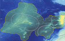
Portugal’s SEAMAP 2030 programme is on an unprecedented mission to meticulously chart the country’s maritime depths, contributing a vital piece of the global puzzle to the monumental GEBCO bathymetric grid....

Andrijana Horvat is R&D lead geophysicist and GIS specialist at Hidrocibalae, with a Master’s in Geography from the University of Zagreb. Her professional interests include hydrography, GIS, Python programming and cartography,...

Dino Dragun is CEO and founder of Hidrocibalae, a marine geophysical data centre, with over ten years of experience in the offshore industry as a data processor/surveyor/party chief, covering geophysical...
Rapid technological advancements in AI, machine learning and automation urge the offshore industry to keep up to date with innovations and use them to make data acquisition and data processing...
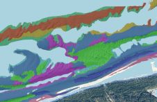
This article presents a novel methodological approach to understand and assess the suitability of airborne Lidar bathymetry for the automatic classification and mapping of the seabed. This solution allows recording of...
Sulmara recently successfully completed an unexploded ordnance (UXO) and multibeam (MBES) survey of Ardersier Port, Scotland. The port is currently undergoing a significant regeneration project involving construction and dredging to...
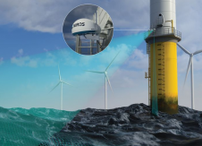
Ocean insights leader Miros recently unveiled WaveFusion, a groundbreaking dual sensor designed to measure directional wave spectra in response to the offshore wind industry’s demands.WaveFusion enhances data performance and reliability...
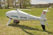
RIEGL Laser Measurement Systems and Schiebel have successfully completed the integration of a high-end laser scanning system, the RIEGL VQ-840-G topobathymetric Lidar sensor, on the Schiebel Camcopter S-100 uncrewed aerial...
This site uses cookies. By continuing to use this website, you agree to our Cookies Policy. Agree