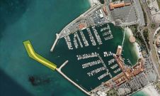
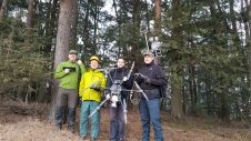
Found 56 results
Sort by

Martin Pfennigbauer

Dr Martin Pfennigbauer holds a PhD in engineering from Vienna University of Technology. He has been employed by RIEGL Laser Measurement Systems since 2005, presently as director of research and...

Read more

Pushing Lidar to the Limits

Airborne bathymetric Lidar is an ideal tool to study underwater features in the usually rather clear waters along the coast of Australia. Due to the remoteness of many of the...

Read more

Ocean Business Ready for Business

The bi-annual event Ocean Business is coming to the NOC, Southampton from 4-6 April 2017. Three days of ocean technology engineering and science, knowledge sharing, hands-on training and demos as...

Read more

YellowScan

High Precision, Long-Range UAV Lidar & Drone Lidar Mapping Solutions At YellowScan, we design, develop and build Lidar solutions for professionals that require performance, robustness and accuracy. Our hardware and...

Read more

Marine Asset Integrity Mapping

Advances in marine & terrestrial scanning survey techniques together with precise inertial navigation sensors, multi-sensor acquisition systems and cost-effective UAS photogrammetry allow hydrographic surveyors to undertake high-precision marine asset integrity...

Read more