Welcome to the New Geospatial
Teledyne Optech and Teledyne CARIS have united to form Teledyne Geospatial in response to evolving marketplace needs. Under the Teledyne Imaging group, the harmony between the two business units is...
Teledyne Optech and Teledyne CARIS have united to form Teledyne Geospatial in response to evolving marketplace needs. Under the Teledyne Imaging group, the harmony between the two business units is...
TCarta Marine, a global provider of hydrospatial products, will demonstrate the new Trident Satellite Derived Bathymetry (SDB) Toolbox, now available as a software-as-a-service product, at GEOINT 2021, which is being...
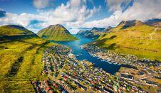
Crewless aerial mapping was recently chosen when surveying the Faroe Islands. For the small team, labour savings provided one advantage of a UAV-based approach. Another benefit was that clear skies...
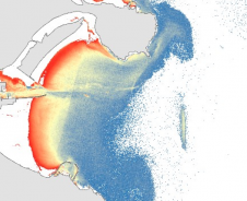
Israeli drone service provider ERELIS recently conducted a number of pilot projects using a drone equipped with a single-beam echosounder in the Mediterranean and Dead Sea. The reference bathymetric data...
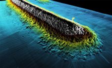
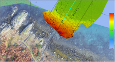
Mapping shallow, nearshore areas can be a challenging job. The waters along coasts and islands are important to human activities, but when it comes to mapping these areas there is...
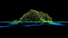
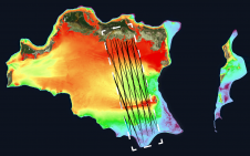
RIEGL tested the performance of its topobathymetric airborne laser scanning system in a transition zone context along the French Mediterranean coast. Initially planned as a UAV survey, tests were conducted...
XOCEAN has completed 35 cable inspection surveys using a combination of uncrewed surface vessels (USVs) and uncrewed aerial vehicles (UAVs) between the Scottish mainland and Western Isles. There was a...
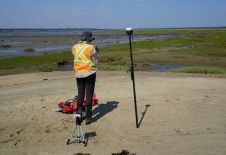
This article presents a participative geomatics project with the goal of increasing southern Québec’s coastal communities’ ability to map and monitor changes in their coastal environment. Capacity-building and empowerment using...
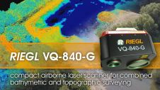
The RIEGL VQ-840-G is a compact Topo-Bathymetric Airborne Laser Scanner especially suited for coastline and shallow water mapping providing more than 2 Secchi depths water penetration. The scanner provides high...

Herjuno Gularso is a mapping surveyor at the Center for Marine and Coastal Environment Mapping at the Geospatial Information Agency. He received a Bachelor’s degree in Geodesy Engineering from Diponegoro...
This site uses cookies. By continuing to use this website, you agree to our Cookies Policy. Agree