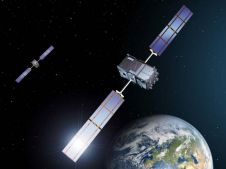
What is GNSS Spoofing?
With spoofing attacks on the rise, survey-grade GNSS receivers need to be protected by interference mitigation technology utilizing the latest security techniques to ensure reliable positioning. The survey and mapping...
With spoofing attacks on the rise, survey-grade GNSS receivers need to be protected by interference mitigation technology utilizing the latest security techniques to ensure reliable positioning. The survey and mapping...
Fugro has won a contract to capture bathymetric Lidar of Northern Ireland’s coastline as part of a project from the Department of Agriculture, Environment and Rural Affairs (DAERA) to create...

Hydro International spoke to five leading experts about the present and future of the hydrographic industry. In this interview, Eric Langlois (International Federation of Hydrographic Societies) focuses on the next...
MarineDash is a newly launched online service designed to connect vessel owners with prospective charterers. The service will cater initially to vessels for hydrographic and geophysical survey, ROV and dive...
Sunrise over the little harbour of the Royal Netherlands Institute for Sea Research (Royal NIOZ), with one of the research vessels of the institute in the background. Royal NIOZ is...
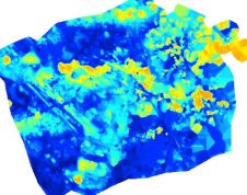
How can AUVs be reliably used to map the 3D structure of the underside of sea ice, especially now that the climate crisis makes it more important than ever to...
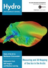
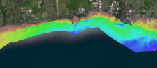
The cover of this edition of Hydro International shows imagery acquired with the Kongsberg EM 2040P MKII, an advanced shallow water multibeam echosounder. In this issue, you will find an...
Fugro has successfully trialled a major upgrade to its Fugro LADS airborne lidar bathymetry (ALB) system. The enhanced LADS HD+ technology was developed in Fugro’s laser laboratory in Adelaide, Australia,...
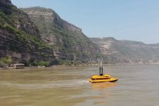
With a total length of 5,464km, the Yellow River is the second-longest river in China. Its middle section runs through the Loess Plateau, where it picks up sand and dust,...
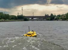
This paper explores the various features of the Apache USV series for efficient seafloor-level mapping. The CHCNAV hydrographic survey software is used for data recording and analysis. It provides results...
This site uses cookies. By continuing to use this website, you agree to our Cookies Policy. Agree