Found 933 results
Sort by

Assessing the Quality of Soundings

Ensuring that your hydrographic data complies with the latest standards can be difficult, particularly as standards continually change with new advances in technology. Simon Squibb discusses a ‘binning’ technique that...

Read more

Hydrography for Exploration

In the last half century Hydrography has grown from a Government commitment, solely for the purpose of producing nautical charts and information for safe navigation, into a science indispensable to...

Read more

The Dutch Sector of the North Sea

The North Sea directorate of the Ministry of Public Works and the department of Geo-Marine & Coast of The Netherlands Institute of Applied Geoscience-TNO jointly carried out a geological mapping...

Read more

Supply Hydrographic Personnel

There is a global shortage of hydrographic surveyors. The industry is faced with an interesting challenge and looks to specialised education facilities and personnel suppliers to assist in solving this...

Read more

Ocean Survey - The World Market

Over the past thirteen years Douglas-Westwood Limited has produced a series of occasional techno-economic studies of the Ocean Survey industry. This latest, The World Ocean Survey Report 2004-2008 aims to...

Read more

The ROV in Nearshore Site Investigation

Nearshore engineering surveys are undertaken for the purpose of gathering information pertaining to the bathymetry and morphology of the seabed, along with the geotechnical characteristics and geophysical profiles of the...

Read more

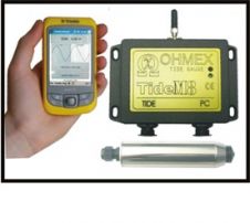
Bluetooth Tide Gauge

TideM8 is a combination of the Ohmex TideM8 miniature tide gauge system and Trimble's Juno hand-held Mobile PC with integrated GPS. The system is a new design based on the...

Read more

Automated Side-scan Data Analysis

Side-scan sonar is well accepted as a tool for detection and visualisation of underwater objects and is widely used in support of safety of navigation surveys. Although side-scan sonars produce...

Read more

The Order of Canada

There were three major overlapping phases in Mike Eaton’s career: Arctic developments in the Canadian Hydrographic Service, positioning systems development while at the Bedford Institute and electronic chart development after...

Read more