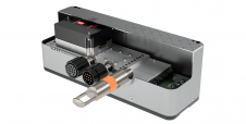
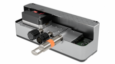
Found 50 results
Sort by

EM 2042

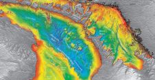
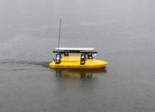
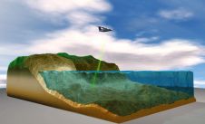
EM 2042 Multibeam Echosounder Small in size, but powerful in potential, the EM 2042 Multibeam Echosounder is efficient, light, robust and reliable: delivering high-density, high-resolution, clean data in the most demanding marine environments. With...

Read more

Automatic calibration for MBES offsets

Currently, calibration of multibeam echosounders (MBES) for hydrographic surveys is based on the traditional ‘patch test’ method. This subjective method, although rigorous, has major drawbacks, such as being time-consuming (in...

Read more

Technology in Focus: Bathymetric Lidar

Bathymetric Lidar is the most effective and cost-efficient technology to capture both the land and sea floor simultaneously, in order to provide a continuous, detailed 3D elevation model along the...

Read more

Marine Asset Integrity Mapping

Advances in marine & terrestrial scanning survey techniques together with precise inertial navigation sensors, multi-sensor acquisition systems and cost-effective UAS photogrammetry allow hydrographic surveyors to undertake high-precision marine asset integrity...

Read more