MARS Explorer Version 4.0
Merrick & Company, a world leader in LIDAR, digital ortho imaging, photogrammetry and GIS mapping announces the release of version 4.0 of the Merrick Advanced Remote Sensing (MARS) software product...
Merrick & Company, a world leader in LIDAR, digital ortho imaging, photogrammetry and GIS mapping announces the release of version 4.0 of the Merrick Advanced Remote Sensing (MARS) software product...
In conjunction with Ocean Business 2007, the conference Offshore Survey 2007 is organised. Adam Kerr followed the lectures and reports about them. After the coffee break, the programme turned to...
US Hydro 2007 Conference takes place this month in Norfolk, Virginia, organised by the Hydrographic Society of America. It will be the eleventh event of its kind, celebrating the two...
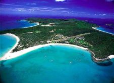
Fugro Pelagos, Inc. was selected to be among the three best-qualified firms to provide LIDAR Hydrographic Surveying and Related Support Services anywhere in the U.S. for the National Oceanic and...
Applanix has released version 4.3 if its airborne data post-processing software POSPac AIR, incorporating a series of application-specific tools for systems using the company’s direct georeferencing technology POS AV (Position...
Low-budget Hydrography is the theme of this issue. Realising that different players in hydrography will have differing opinions on various aspects of low-budget hydrography and interested in exploring these divergent...
Norfolk, Virginia, a city that has played a major role in US maritime history, was the venue for U.S. Hydro 2007. Two hundred years after the founding of the US...
The Royal Australian Navy’s Australian Hydrographic Service has recently added to its survey capability with the innovative use of reservist hydrographic surveyors in a mobile survey team. Earlier this year,...
Shallow Survey 2005 Common Dataset Comparisons As part of the Shallow Survey Conference 2005 held in Plymouth, swath sonar manufacturers were invited to survey a common dataset. Two regions were...
In the last half century Hydrography has grown from a Government commitment, solely for the purpose of producing nautical charts and information for safe navigation, into a science indispensable to...
This site uses cookies. By continuing to use this website, you agree to our Cookies Policy. Agree