Ten Years of Exploration with AWI’s Research Aircraft Polar 5
On 1 October 2017, the Alfred Wegener Institute, Helmholtz Centre for Polar and Marine Research (AWI) research aircraft Polar 5 had been in service for precisely ten years. In that...
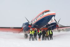
On 1 October 2017, the Alfred Wegener Institute, Helmholtz Centre for Polar and Marine Research (AWI) research aircraft Polar 5 had been in service for precisely ten years. In that...
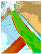
The United Kingdom Hydrographic Office (UKHO) supported the safe arrival of HMS 'Queen Elizabeth' into Portsmouth on 16 August 2017 by providing specialist marine geospatial and hydrographic expertise and data...
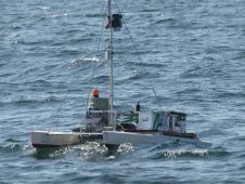
RV 'Falkor' has left Darwin, Australia, to explore the poorly understood air-sea interactions across the Indian and Pacific Oceans. The team of sea surface experts and marine geochemists on the...
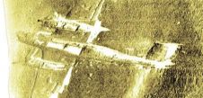
On 11 June 2013, experts from the UK's RAF Museum salvaged the Dornier Do17 Luftwaffe aircraft – which was shot down offshore Kent more than 70 years ago – and...

In an era of environmental challenges and economic uncertainties, nations are earnestly seeking innovative ways to stimulate economic development, improve public safety and enhance the quality of life for their...
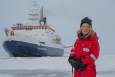
After eventful and busy months, the Arctic season of the ArcWatch-1 Polarstern expedition ended this weekend. The team of almost 100 crew and scientists measured sea ice thickness and properties,...
Deep-sea explorers scouring the world’s oceans for sunken Second World War ships have uncovered the wreck of a Japanese aircraft carrier destroyed in the Battle of Midway. Fought on June...
The National Oceanic and Atmospheric Administration (NOAA) has signed Woolpert to a US$7 million contract to perform hydrographic surveying and collect bathymetric data in and around Nome, Alaska. This data...
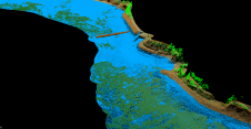
As part of a Catalan government project to improve the management of its marine environment, ICGC cooperated with Field to use airborne Lidar bathymetry (ALB) to survey the Catalan coastal...
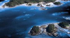
The National Oceanic and Atmospheric Administration (NOAA) contracted NV5 Geospatial to define the shoreline in an extremely complex area of south-east Alaska as part of the NGS Coastal Mapping Program....
This site uses cookies. By continuing to use this website, you agree to our Cookies Policy. Agree