BedMachine Will Help Reduce the Uncertainty in Sea Level Rise
A team of glaciologists has unveiled the most accurate portrait yet of the contours of the land beneath Antarctica’s ice sheet – and, by doing so, has helped identify which...
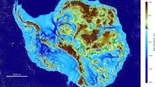
A team of glaciologists has unveiled the most accurate portrait yet of the contours of the land beneath Antarctica’s ice sheet – and, by doing so, has helped identify which...
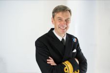
The UK Hydrographic Office (UKHO) has announced the appointment of Rear Admiral Peter Sparkes to the position of National Hydrographer and Deputy Chief Executive: a role that helps to improve...

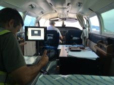
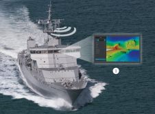
The Rapid Airborne Multibeam Mapping System, RAMMS, was developed over a period of three years before it was officially launched in the summer of 2018. Senior hydrographer Richard Goosen describes how Fugro used the system for coastal and nearshore mapping at the paradisal Turks and Caicos Islands. Insight into the use of the Rapid Airborne Multibeam Mapping System (RAMMS) for coastal and nearshore mapping at the paradisal Turks and Caicos Islands. The Rapid Airborne Multibeam Mapping System,...
Phil Payne, survey delivery manager of the UK Hydrographic Office talks about hydrographic programmes to support blue economic growth, intentional projects and the use of lidar for charting purposes. "There will be a continued drive towards autonomy and automated processing.” Phil Payne, survey delivery manager of the UK Hydrographic Office talks about hydrographic programmes to support blue economic growth, intentional projects and the use of lidar for charting purposes. ”There...

While standing on a small ship near Bikini Atoll in the Marshall Islands during the summer of 2019, University of Delaware Professor Art Trembanis looked up and realized that if...
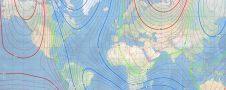
The World Magnetic Model is a joint product of the United States’ National Geospatial-Intelligence Agency (NGA) and the United Kingdom’s Defence Geographic Centre (DGC). The WMM was developed jointly by...
WASSP Multibeam has launched its new rapid deployment multibeam sounder – the W3 Rapid Deployment System (RDS). Revealed at the recently held Pacific Expo 2019 in Sydney, Australia, W3 RDS...
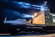
After a decade of preparations, the German icebreaker Polarstern will be departing from the Norwegian port of Tromsø. Escorted by the Russian icebreaker Akademik Fedorov, she will set sail for the...

EOMAP has been awarded by the German Aerospace Center (DLR) to further develop its physics-based method of mapping the depth of the sea from satellite observations. Satellite-Derived Bathymetry (SDB) uses data...
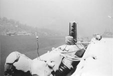
The French navy has located La Minerve, one of its submarines that disappeared more than 50 years ago. Onboard were 52 crewmembers. The submarine was discovered on the seabed at...
This site uses cookies. By continuing to use this website, you agree to our Cookies Policy. Agree