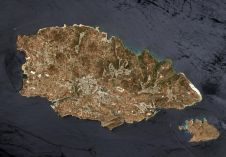
CARIS Spatial Fusion Enterprise 5.2
CARIS is to release Spatial Fusion Enterprise (SFE) 5.2 as part of its Ping-to-Chart product suite. SFE is Web-enabling technology for geospatial information that aims at leveraging the investment of...
CARIS is to release Spatial Fusion Enterprise (SFE) 5.2 as part of its Ping-to-Chart product suite. SFE is Web-enabling technology for geospatial information that aims at leveraging the investment of...

The Hydrographic Department, Royal Thai Navy (HDRTN) implemented an enterprise production system in early 2014. The enterprise geographic information system (GIS) will enhance the management and provision of spatial data...
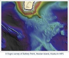
Teledyne CARIS has entered into an Enterprise Licensing Agreement with Fugro. This agreement will enable Fugro worldwide on-demand access to CARIS software, specifically HIPS and SIPS for the purposes of...
The U.S. Integrated Ocean Observing System (IOOS), part of the National Oceanic and Atmospheric Administration (NOAA) and the Department of Commerce, has released a first-of-its-kind study that looks at the...
As the demand for clean energy continues to grow, there has been a corresponding increase in the development of offshore wind farms to help meet energy needs. However, it is...
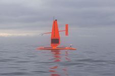
Marine energy, defence and science company Sonardyne has been selected to provide a subsurface communications and navigation network for the Smart Sound Connect Subsurface (SSCS) Project. Sonardyne will partner with...

Terradepth, a leading provider of ocean data solutions, has been selected to participate in the World Economic Forum’s (WEF) prestigious Ocean Data Challenge, a programme aimed at enhancing sustainable ocean...
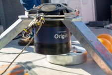
Malta has been chosen as the main location for the production, development and worldwide distribution of hydrographic survey systems by R3Vox. The company's core activity is creating advanced hydrospatial survey...
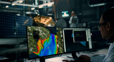
Terradepth has launched Absolute Ocean (AO), a cloud-based geospatial solution providing high-level visualization, analysis, collaboration and management of all marine data. In addition to offering Absolute Ocean as a software-as-a-service...
This site uses cookies. By continuing to use this website, you agree to our Cookies Policy. Agree