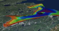
The evolution of Dutch hydrography
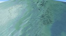
Given the Netherlands’ geographical location, it is unsurprising to find it has a long tradition of hydrography. The lowland, often below sea level, forms a delta where major rivers from...

Given the Netherlands’ geographical location, it is unsurprising to find it has a long tradition of hydrography. The lowland, often below sea level, forms a delta where major rivers from...
Teledyne Geospatial has announced that Tetra Tech, a leading provider of high-end consulting and engineering services, recently acquired a Teledyne Optech CZMIL SuperNova Topobathymetric Lidar system. Tetra Tech has successfully...
Lidar, short for Light Detection and Ranging surveying, represents a sophisticated measuring system leveraging the power of light. Widely recognized for its versatility, Lidar is extensively applied in diverse fields...

How do you perceive prospects in the hydrographic surveying industry in 2024, compared to the past couple of years? When contemplating the hydrographic sector holistically, which areas of investment do...
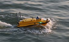
CHC Navigation (CHCNAV), a leading manufacturer of uncrewed surface vehicle (USV) technology, has introduced the Apache 3 Pro – an advanced compact hydrographic drone engineered for autonomous bathymetric surveys in...
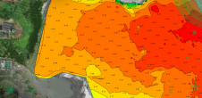
All over the world, surveyors are opting for UAV technologies to advance coastal mapping services. VBW Weight GmbH from Germany and RASA Surveying from the Philippines are professional service providers...
On 24 January 2023, the European Union declared the Galileo High Accuracy Service (HAS) operational for testing, and it is scheduled to become fully operational in 2024. This free signal adds...
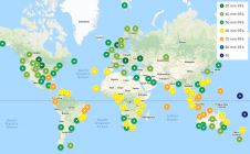
Memorial University of Newfoundland’s Marine Institute has entered into a partnership with The Nippon Foundation-GEBCO Seabed 2030 Project. The university’s collaboration with the Seabed 2030 initiative will involve providing invaluable...
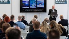
Preparations for Ocean Business 2023 are well underway, and it promises to be a sold-out event. Scheduled for 18–20 April, the conference programme will feature industry experts speaking on the...
GEOMOD is a software development company specialized in marine geomatics and hydrography. Since 2004, we have been building our expertise on hydrographic products dedicated to mariners, harbour workers, and hydrographic...
This site uses cookies. By continuing to use this website, you agree to our Cookies Policy. Agree