First USF Uncrewed Mission to Map Vulnerable Coastal Areas in Florida
University of South Florida marine scientists launched their first field mission in Tampa Bay and the Gulf of Mexico to test a new approach to mapping shallow coastal areas –...
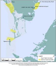
University of South Florida marine scientists launched their first field mission in Tampa Bay and the Gulf of Mexico to test a new approach to mapping shallow coastal areas –...
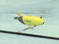
Ocean Floor Geophysics (OFG) and DOF Subsea (DOF) have entered into a strategic alliance for Autonomous Underwater Vehicle (AUV) services to the global offshore industry. The partnership will effectively leverage...
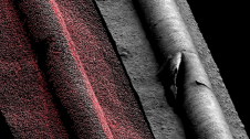
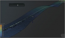
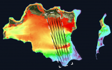
Subsea pipelines are an integral component of offshore oil and gas production and are one of the most discussed topics in the subsea survey community. Ongoing inspection of these assets...
A topographic survey collects information about the land's natural and man-made characteristics, as well as its terrain. Buildings, fences, trees, and waterways are permanent structures that accurately define the ground and its boundaries. The elevation of the terrain is depicted by land contours and spot levels. Architects, engineers, construction builders, and others utilize topographic maps to precisely visualize their sites and speed up development. A topographic survey collects information about the land's natural and man-made characteristics, as well as its terrain. Buildings, fences, trees, and waterways are permanent structures that accurately define the ground...
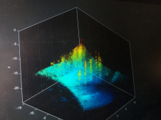
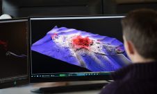
In collaboration with four French, Belgian and German geoscience laboratories, iXblue’s sonar systems division recently mobilized its SeapiX 3D multibeam echosounder and Echoes 10,000 sub-bottom profiler to image the Laacher...
Teledyne Geospatial brings its latest advancements in bathymetric Lidar and ocean mapping software solutions to Ocean Business 2021, being held at the National Oceanography Centre, Southampton, UK from 12–14 October,...
TCarta Marine, a global provider of hydrospatial products, will demonstrate the new Trident Satellite Derived Bathymetry (SDB) Toolbox, now available as a software-as-a-service product, at GEOINT 2021, which is being...
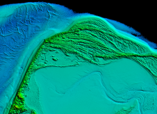
Arctia-Meritaito has efficiently produced a seamless digital terrain model of land and water along the shallow coastal areas of the German island of Sylt, using a Leica Chiroptera 4X airborne...
Kawasaki Heavy Industries (KHI) has chosen a suite of subsea navigation, positioning and communications technologies from marine energy, defence and science company Sonardyne to navigate, track and control its first...
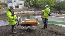
In early spring 2021, Storm Geomatics were approached by an existing client to carry out topographic and bathymetric surveys on the River Aire, in the village of Newlay, to the...
This site uses cookies. By continuing to use this website, you agree to our Cookies Policy. Agree