FEMME – Kongsberg Discovery’s mapping conference
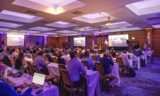
After a long break due to the COVID-19 pandemic, Kongsberg recently organized its 17th Forum for the Exchange of Mutual Multibeam Experiences (FEMME) in Edinburgh, UK. The FEMME conference brought...
After a long break due to the COVID-19 pandemic, Kongsberg recently organized its 17th Forum for the Exchange of Mutual Multibeam Experiences (FEMME) in Edinburgh, UK. The FEMME conference brought...
FarSounder is partnering with The Nippon Foundation-GEBCO Seabed 2030 Project to work together to advance the collective understanding of the ocean floor in pursuit of the complete map of the...

Through the collaborative implementation of satellite-derived bathymetry (SDB), the Danish Geodata Agency and EOMAP are synergizing efforts to contribute to the European Marine Observation and Data Network (EMODnet) Bathymetry partnership....

How do you perceive prospects in the hydrographic surveying industry in 2024, compared to the past couple of years? When contemplating the hydrographic sector holistically, which areas of investment do...
Delving into the mysteries of the planet’s final frontier – the ocean – has long captivated human curiosity, with the origins of ocean exploration dating back to 5,000 BC. But...
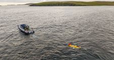
The National Oceanography Centre (NOC), working with the University of Southampton and the Department for Environment, Food and Rural Affairs (Defra), recently completed a Fully Autonomous Marine Protected Area Seafloor...

The development of unmanned and autonomous surface vehicles in recent years has triggered a new era in civilian and military maritime operations. One of the applications that is likely to...
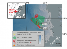
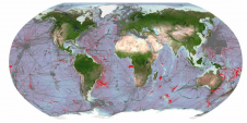
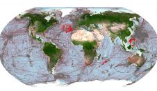
World oceans host diverse creatures that shape the seafloor. In a groundbreaking interdisciplinary study published in Communications Earth & Environment, Kiel University geoscientists, alongside biology and oceanography experts, have linked...

The 2023 GEBCO Week, taking place on 7–8 November, will bring together ocean explorers, mapping experts and stakeholders from all over the world to discuss progress in ocean exploration, new...
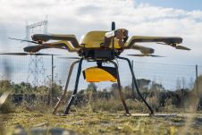
YellowScan, a familiar name in the mapping and land surveying realm, is making a noteworthy entrance in the hydrographic sector with the introduction of its pioneering UAV-based bathymetric Lidar solution....
This site uses cookies. By continuing to use this website, you agree to our Cookies Policy. Agree