Mobile 2.0 for iPhone
Navionics will be hitting the water with the newest version of our Mobile App created specifically for iPhone users. The charts are available for an expert mariner already familiar with...
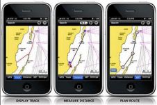
Navionics will be hitting the water with the newest version of our Mobile App created specifically for iPhone users. The charts are available for an expert mariner already familiar with...
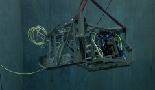
In a bid to uncover the secrets of the deep seafloor, the Monterey Bay Aquarium Research Institute (MBARI) has joined forces with 3D at Depth, a leading expert in commercial...
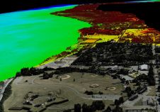
“Think big for coastal mapping” is the foremost advice that Don Ventura of Teledyne Geospatial would impress upon agencies interested in bathymetric Lidar. “It’s a matter of efficiency of scale.”...
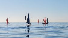
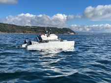
Saildrone, a company renowned for providing near real-time maritime intelligence using small unmanned systems, has introduced a new line of unmanned surface vehicles (USVs) in the mid-size category. The Voyager,...
Measuring suspended particulate matter in the water column is still a big challenge when it comes to covering large areas in the sea or rivers. A novel method to monitor particles...
Aurigo Software, a leading provider of capital planning and construction management software for infrastructure and private owners, is partnering with the University of Florida’s Department of Mechanical and Aerospace Engineering...
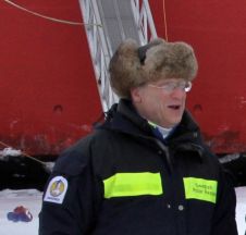
Larry Mayer is a professor and director of the Center for Coastal and Ocean Mapping at the University of New Hampshire. His research deals with sonar imaging and remote characterization...
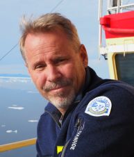
Martin Jakobsson is professor of Marine Geology and Geophysics at Stockholm University. His research interests include the marine cryosphere, with a current focus on northern Greenland, glacial landforms and seafloor...
HydroSurv has won funding from Innovate UK to continue working with the University of Plymouth to enhance its technique of using uncrewed surface vessels (USVs) to map seagrass coverage on...

Renewable energy and the pivotal role of hydrography in offshore development take centre stage in a captivating interview with Professor Ed Hill, chief executive of the National Oceanography Centre (NOC)....
This site uses cookies. By continuing to use this website, you agree to our Cookies Policy. Agree