Capturing the Arctic and Antarctic
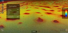
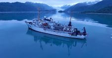
Capturing and measuring the environment in the Arctic and Antarctic is a particularly challenging job. The area of interest is often covered by a thick blanket of snow and ice,...
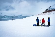
Capturing and measuring the environment in the Arctic and Antarctic is a particularly challenging job. The area of interest is often covered by a thick blanket of snow and ice,...
With the 2022 hurricane season upon us, the importance of using science-backed solutions for hurricane preparedness is brought to the foreground. Since Colombia’s Caribbean islands were devastated by hurricanes Eta...
Geosciences survey companies face a constant challenge in securing and moving data. Operating in far-flung, barely connected parts of the world, with temperatures and weather hard to predict, they deploy scanning and...
Imaging and geo-engineering specialist Argeo entered into an agreement for AUV work for Statens Vegvesen (Norwegian Public Roads Administration) on the Bjørnafjorden E36 crossing. The project, valued at 8.5 million NOK,...
TCarta Marine, the Colorado-based provider of hydrospatial products, will present its satellite-derived bathymetric (SDB) data sets on Terradepth’s Absolute Ocean visualization platform for the first time at GEOINT 2022. Additional...
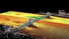
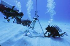
Two Hungarian companies designed a three-step data collection workflow to overcome the challenges in this urban surveying project in Hungary, which included the use of UAVs and remote-controlled boats for...
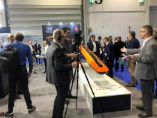
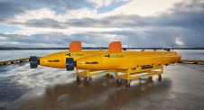
Kongsberg Maritime used Oceanology International 2022 in London as the occasion to launch the HUGIN Edge AUV. The latest addition to Kongsberg Maritime’s HUGIN family builds on the capabilities of...
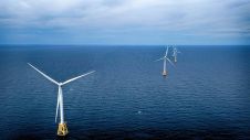
NOAA and the Bureau of Ocean Energy Management (BOEM) recently signed an interagency memorandum in support of the Biden-Harris Administration’s ambitious offshore wind energy goals to advance wind energy responsibly...
NOAA hydrographic survey ships and contractors are preparing for the 2022 hydrographic survey season in U.S. coastal waters and beyond. The ships collect bathymetric data (i.e. map the seafloor) to...
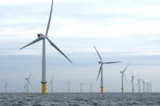
RWE Renewables has appointed ABPmer to support the design of the Awel y Môr Offshore Wind Farm in the Irish Sea. The marine consultancy company is assessing the sediment mobility...
This site uses cookies. By continuing to use this website, you agree to our Cookies Policy. Agree