EMODnet Geology updates seabed maps for EU and Caribbean
EMODnet Geology is extending its offer with new and updated data products on seabed substrate maps for EU waters and the Caribbean Sea and seabed erosion. The European Marine Observation...
EMODnet Geology is extending its offer with new and updated data products on seabed substrate maps for EU waters and the Caribbean Sea and seabed erosion. The European Marine Observation...
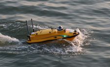
Combining the DriX uncrewed surface vehicle (USV) and the FlipiX remotely operated towed vehicle (ROTV), Exail has developed a unique solution enabling fully autonomous and remotely operated surveys. Combining the DriX uncrewed surface vehicle (USV) and the FlipiX remotely operated towed vehicle (ROTV), Exail has developed a unique solution enabling fully autonomous and remotely operated surveys. Accurate surveys...
Hydro International’s annual Business Guide is now available! We take pride in presenting a comprehensive reference work featuring the results and analysis of our industry survey, a tradition we are honoured to uphold. This year’s report, incorporating valuable input from survey participants, is more extensive and in-depth than ever. Hydro International’s annual Business Guide is now available! We take pride in presenting a comprehensive reference work featuring the results and analysis of our industry survey, a tradition we are...
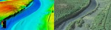
The US Geological Survey (USGS) and Dewberry have jointly released a new topobathymetric Lidar dataset for the Potomac River, extending from the Potomac Highlands in West Virginia to the Chesapeake...
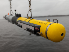
L3Harris, Voyis and Wavefront have joined forces to introduce cutting-edge technology aimed at enhancing the autonomous underwater vehicle (AUV) capabilities of the NATO Navy. L3Harris specializes in the development of...

Ocean data has a vital but underappreciated role to play as an enabler in shipping’s energy transition. In particular, it can help to unlock the short-term carbon savings that will...
CHC Navigation (CHCNAV), a leading manufacturer of uncrewed surface vehicle (USV) technology, has introduced the Apache 3 Pro – an advanced compact hydrographic drone engineered for autonomous bathymetric surveys in...

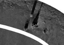
Various attempts have recently been made to expand the scope of research in the maritime field through the convergence of cutting-edge technologies. One example is the remote classification and prediction...
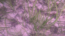
Seagrass meadows play an invaluable role as critical ecosystems that contribute significantly to marine biodiversity, carbon sequestration and coastal protection. In recent years, the importance of these underwater habitats has...
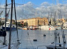
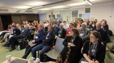
Hydro 2023 took place from 7 to 9 November in the beautiful port city of Genoa in Italy. Organizers of this year’s edition of the hydrographic conference were the International...
This site uses cookies. By continuing to use this website, you agree to our Cookies Policy. Agree