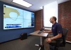
Who is going to map the high seas?
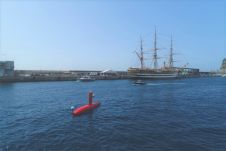
To achieve the aggressive goals of Seabed 2030, uncrewed survey systems must be used to augment more traditional ocean mapping efforts, particularly on the high seas. In addition to providing...
To achieve the aggressive goals of Seabed 2030, uncrewed survey systems must be used to augment more traditional ocean mapping efforts, particularly on the high seas. In addition to providing...
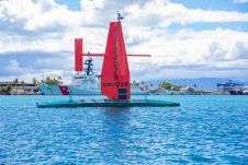
Invited by the International Hydrographic Organization (IHO) to demonstrate the most modern hydro-oceanographic technologies during the celebrations marking the 100 years of existence of the international organization, iXblue demonstrated its...
Israeli drone service provider ERELIS recently conducted a number of pilot projects using a drone equipped with a single-beam echosounder in the Mediterranean and Dead Sea. The reference bathymetric data...
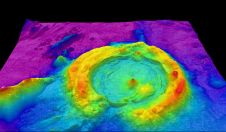
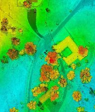
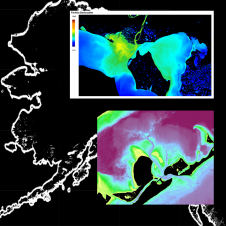
Bathymetric Lidar is a technique that is used to capture geospatial data of coastlines and waterbodies. The method has the potential to facilitate the fast and efficient creation of hydrographic data, and more...
DEA Marine Services, a division of David Evans and Associates, Inc. (DEA), of Vancouver, Wash., has invested in and utilized Sea Machines Robotics’ autonomous command and remote helm control system...
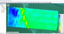
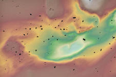
As the demand for elevation data continues to rise, it is important that users match the level of reliability, accuracy and resolution of the data to their specific application to...
The British Royal Navy has tested cutting-edge software to map the seabed close to shore in hours – not days or weeks. Survey vessel HMS Magpie was able to chart...
Archaeologists have long been interested in shipwrecks. These sites can tell us about ancient transportation and trading routes, technological innovations and cultural exchanges over thousands of years. Documenting shipwrecks can...
TCarta Marine, a global provider of space-based hydrospatial solutions, has been awarded a Small Business Innovation Research (SBIR) Phase II grant from the National Oceanic and Atmospheric Administration (NOAA). The...
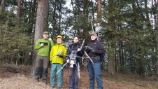
The Finnish Geospatial Research Institute (FGI) has recently added the RIEGL VQ-840-G airborne laser scanner to its impressive collection of sensors. FGI innovators are true scientists, moving the 3D industry...
This site uses cookies. By continuing to use this website, you agree to our Cookies Policy. Agree