Seabed 2030 speeding up to meet its decade target
Seabed 2030 is rapidly approaching its ultimate objective of mapping the entire seabed within seven years. To achieve this goal, the project is actively seeking donations of both public and...

Seabed 2030 is rapidly approaching its ultimate objective of mapping the entire seabed within seven years. To achieve this goal, the project is actively seeking donations of both public and...
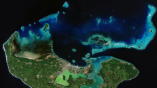
Coastal zones, situated at the intersection of land and ocean, hold immense social, economic and ecological significance. Currently, nearly 40% of the global population resides within 100km of the coast,...
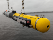
L3Harris, Voyis and Wavefront have joined forces to introduce cutting-edge technology aimed at enhancing the autonomous underwater vehicle (AUV) capabilities of the NATO Navy. L3Harris specializes in the development of...
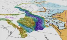
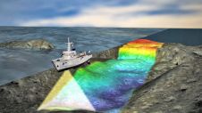
Maps and images of seabed habitat, geology and biological data in the seas around North-West Europe can now be viewed online. This resource has been created by the Joint Nature...
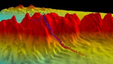
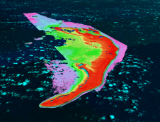
Survey data from a vast underwater valley off East Antarctica, collected during icebreaker RSV Nuyina’s first voyage, has been publicly released through the national seabed mapping programme AusSeabed. The 2,300-metre-deep,...
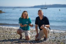
The largest seagrass restoration, education and innovation project in England, LIFE Recreation ReMEDIES, will receive support from environmental sensor manufacturer Valeport for the project’s final two years. The marine conservation...
The Nippon Foundation-GEBCO Seabed 2030 Project has just over nine years left to achieve its indispensable goal of the definitive, freely available map of the entire world ocean floor. The...
TCarta Marine, a global provider of hydrospatial products and services, is expanding its involvement in the Seabed 2030 project. The initiative aims to map the entire ocean floor by 2030,...
This site uses cookies. By continuing to use this website, you agree to our Cookies Policy. Agree