Trimble VX Spatial Station
Trimble has introduced the VX Spatial Station, a positioning system that combines optical, 3D scanning and video capabilities to measure objects in 3D to produce 2D and 3D data sets...
Trimble has introduced the VX Spatial Station, a positioning system that combines optical, 3D scanning and video capabilities to measure objects in 3D to produce 2D and 3D data sets...
An estimated 122 trillion cubic feet of undiscovered, recoverable natural gas are in the eastern Mediterranean's Levant Basin Province, according to a new report released by the United States Geological...
In this article, we examine the evolving landscape of bathymetry with insights from Anders Ekelund, vice president of airborne bathymetric Lidar at Hexagon Geosystems. Beyond mapping seagrass, Ekelund unveils Lidar’s...
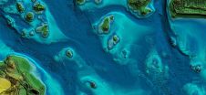
Side-scan sonar is well accepted as a tool for detection and visualisation of underwater objects and is widely used in support of safety of navigation surveys. Although side-scan sonars produce...
Haestad Methods hosted a transient analysis training courses to date. The training program, which was held in Sao Paulo, Brazil on 3-4 June, was designed to educate water professionals on...
The Hong Kong branch of The Nautical Institute is organising a seminar on marine spatial planning on 8 November 2013. Marine spatial planning is becoming increasingly important to the shipping...
The work on Maritime Spatial Planning (MSP) in the Baltic Sea region is being followed up and further advanced in an intensive two-day meeting in Helsinki, Finland. The MSP Working...

'Kiwi' software developer Emma Peace will show her new interactive spatial data visualisation software, Visual Cortex, at the 6th International Shallow Survey Conference to be held at Te Papa, Wellington,...
CARIS is to release Spatial Fusion Enterprise (SFE) 5.2 as part of its Ping-to-Chart product suite. SFE is Web-enabling technology for geospatial information that aims at leveraging the investment of...
On 14th December 2009, US' President Obama's Ocean Policy Task Force released its Interim Framework for Effective Coastal and Marine Spatial Planning (Interim Framework) for a 60-day public review and...
This site uses cookies. By continuing to use this website, you agree to our Cookies Policy. Agree