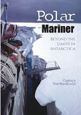
Polar Mariner - Beyond the Limits in Antarctica
A review of Polar Mariner - Beyond the Limits in Antarctica by Capt Tom Woodfield has been made by Ian Russell. The author joined RRS Shackleton for her first voyage after she was acquired by the Falkland Islands Dependencies Survey (now British Antarctic Survey) in 1955 at the same time as...