Improving Satellite-derived Bathymetry
Bathymetry is traditionally acquired using singlebeam or multibeam echosounders. This method produces accurate depth measurements along transects but is constrained by operating co...
 Bathymetric Lidar is a technique to capture geospatial data of the coastline and (shallow) waters. It is a method potentially facilitating efficient and fast creation of hydrographic data. You find articles on this technique and various applications all over the world.
Bathymetry is traditionally acquired using singlebeam or multibeam echosounders. This method produces accurate depth measurements along transects but is constrained by operating co...
Bathymetric Lidar is the most effective and cost-efficient technology to capture both the land and sea floor simultaneously, in order to provide a continuous, detailed 3D elevation...
Every month we will focus on a specific theme, featuring a selection of articles which have previously been published in Hydro International magazine. to present a complete recap of the subject. If you don't want to miss these themed recaps, sign up for the newsletter (sign up here).
Starting in 2005, the French Naval Hydrographic and Oceanographic Office (Service hydrographique et océanographique de la marine [Shom]) and the French National Geographic I...
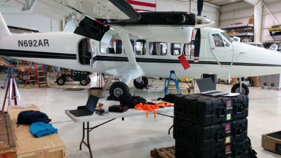
In June 2014, the Bureau of Economic Geology, a research unit at the University of Texas at Austin, was contracted to conduct an airborne bathymetric Lidar survey on the Alaskan No...
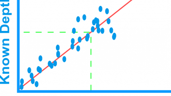
More and more users are demanding bathymetry to support many new and different applications. New applications have necessitated changes in data acquisition and processing technolog...

In his column in 'Hydro International', Mark Sinclair from Fugro writes that he commends the ‘Technology in Focus: Bathymetric Lidar’ article; it is righ...
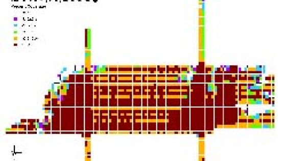
We investigated the most significant issues affecting the creation of a littoral zone digital elevation model from overlapping bathymetric and topographic Lidar (light detection an...
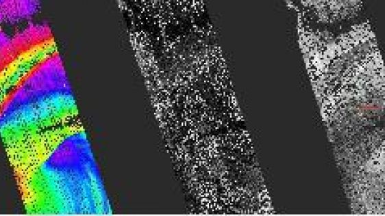
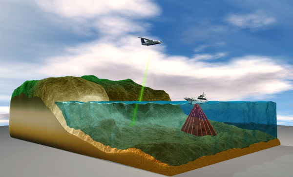
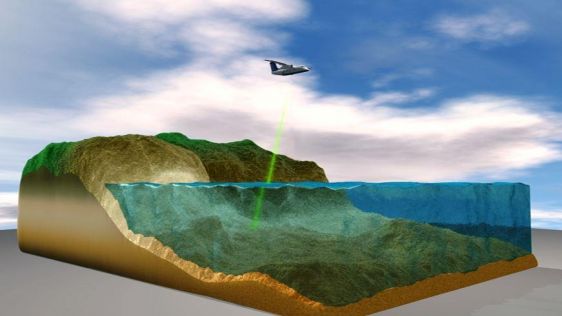
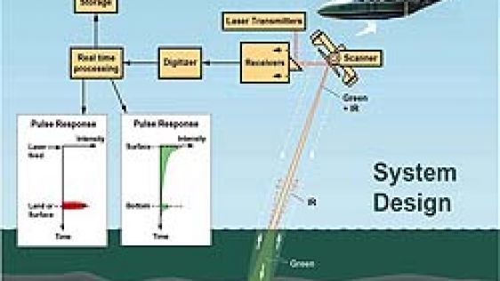
Airborne Lidar (Light Detecting and Ranging) is a well-established remote sensing technique which scans the terrain and seafloor with high-frequency laser pulses. Until now, bathym...
Seabed mapping in the near-shore marine environment is as vital as it is difficult. The Geological Survey of Ireland therefore turned to airborne remote sensing to perform bathymet...
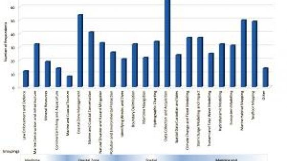
OGC’s new Marine DWG will investigate some critical issues surrounding the usefulness of marine data for purposes other than navigation. In doing this, it hopes to broaden th...
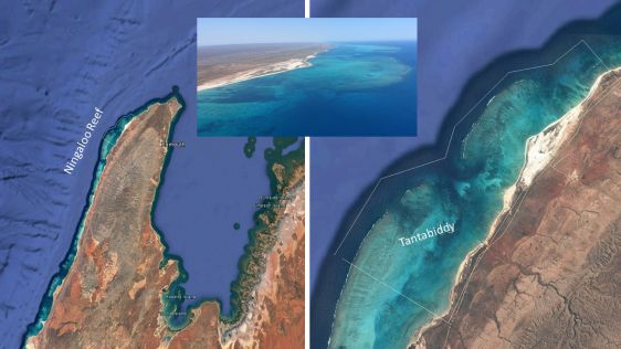
Airborne bathymetric Lidar is an ideal tool to study underwater features in the usually rather clear waters along the coast of Australia. Due to the remoteness of many of the conti...
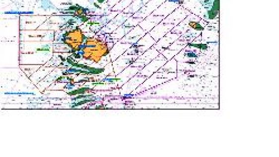
Amongst the largest contracted coastal hydrographic Lidar survey projects awarded in recent years is the Australian Hydrographic Service (AHS) survey of the Torres Strait in Northe...
Follow Hydro International on Facebook, LinkedIn, Twitter or sign up for the newsletter! Don't miss the latest developments: join Hydro International!
 |  |  |  |
| 14.540 SUBSCRIBERS | 7.245 MEMBERS | 5.205 LIKES | 4.632 |
This site uses cookies. By continuing to use this website, you agree to our Cookies Policy. Agree