Lidar Bathymetry on the Alaskan North Slope
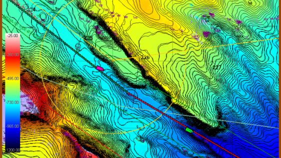
In June 2014, the Bureau of Economic Geology, a research unit at the University of Texas at Austin, was contracted to conduct an airborne bathymetric Lidar survey on the Alaskan No...
Every month we will focus on a specific theme, featuring a selection of articles which have previously been published in Hydro International magazine. By including a mix of older and more recent articles, we will present a complete recap of the subject. Furthermore, we will be bringing you a bi-weekly round-up of ‘Focus Stories’ related to the theme through our newsletter (sign up here). The theme for April 2016 is Shallow Water.
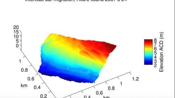
An important area of work in hydrography is shallow water. This month, Hydro International collected papers focussing on shallow-water surveying. Interesting is that this field of work has multiple ways to collect the data: traditionally using a vessel but also techniques like Lidar, satellite bathymetry or hovercrafts (and smaller) are used.
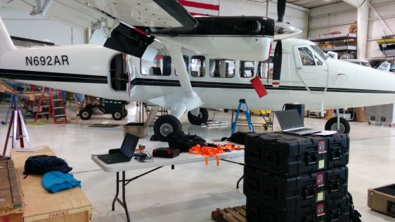
In June 2014, the Bureau of Economic Geology, a research unit at the University of Texas at Austin, was contracted to conduct an airborne bathymetric Lidar survey on the Alaskan No...
In order to meet the requirements of the European Water Framework Directive (EU-WFD), authorities face the problem of performing area-wide surveys of all kinds of inland waters rep...
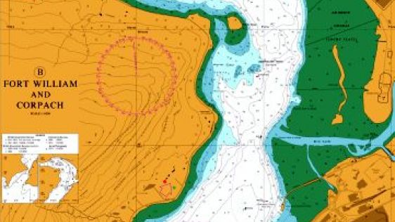
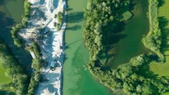
Due to their particularly shallow and turbulent thermocline, conducting seafloor mapping in lochs, fjords and other estuaries always presents a unique challenge to the hydrographic...
Survey efforts in shallow water present a challenge; when coupled with protected species and critical habitat such as coral reefs, they can prove impossible. Tetra Tech, in conjunc...
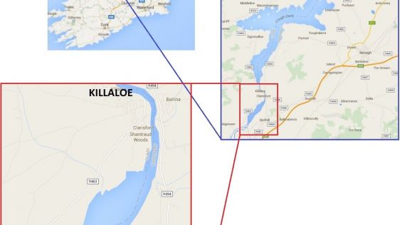
During the last week of a hydrographic survey of Lough Derg, Ireland’s third largest lake, the remnants of a preserved flooded landscape were unveiled beneath the surface wit...
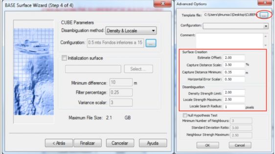
Interferometric sonars acquire millions of soundings in a hydrographic survey. The processing of this data by a hydrographer without a reliable statistical algorithm like CUBE (Com...
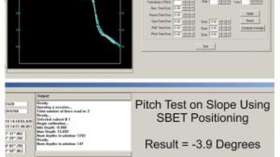
High-resolution multi-beam echo sounder (MBES) surveys should not be conducted where the uncertainty of the horizontal positioning system is larger than the nadir footprint of the...

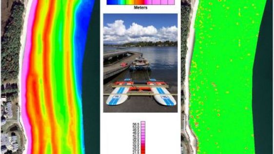
The River Murray Operations Unit (RMOU) of the South Australian Water Corporation surveys very shallow waters, a type of surveying that has its own specific problems overcome by no...
Proteus FZC, EOMAP and DigitalGlobe have formed a partnership to bring satellite-derived bathymetry and seabed classification to the hydrographic community. A pilot conducted by UK...
Almost all (99%) international data is transmitted by around 265 subsea cable systems connecting the world. The total length of subsea cables exceeds 1.6 million kilometres, and th...
Since the management of coastal areas came to the attention of marine science, much effort has been expended in applying originally ‘blue water’ measurement technologie...
Shore-based marine radar techniques have recently proved to be an excellent tool for monitoring erosion and accretion in the dynamic nearshore area through repeated and automated l...
Follow Hydro International on Facebook, LinkedIn, Twitter or sign up for the newsletter! Don't miss the latest developments: join Hydro International!
 |  |  |  |
| 14.540 SUBSCRIBERS | 7.245 MEMBERS | 5.205 LIKES | 4.632 |
At Hydro International, we often receive permission requests to use our articles for republishing purposes. Get permission to reuse our content quickly and easily with PLS Permissions Request. Simply search for Hydro International and fill in the article you are looking for.
This site uses cookies. By continuing to use this website, you agree to our Cookies Policy. Agree
