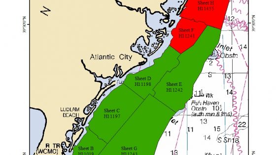
Identification of the Wreck of the U.S.C.S.S. Robert J. Walker
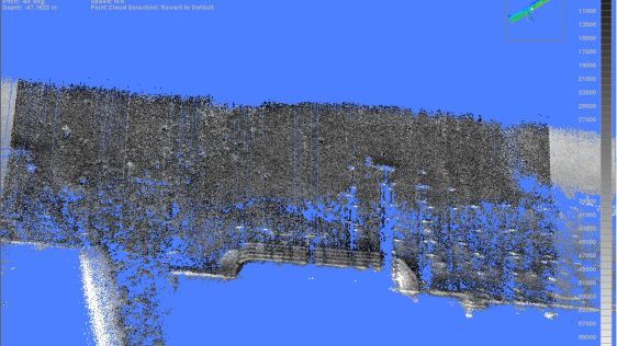
From 21 to 24 June 2013, a NOAA team from the Office of Coast Survey (OCS) and the Office of National Marine Sanctuaries (ONMS) conducted a joint mission to explore a shipwreck off...
Every month we will focus on a specific theme, featuring a selection of articles which have previously been published in GIM International magazine. By including a mix of older and more recent articles, we will present a complete recap of the subject. Furthermore, we will be bringing you a bi-weekly round-up of Focus Stories related to the theme through our newsletter (sign up here).
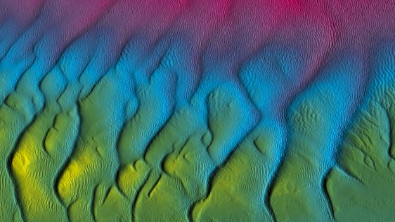
Side-scan sonar is often used to find objects on the seafloor and to inspect objects like pipelines or underwater constructions. Also fisheries, dredging operations and environmental studies are using this technique, along with military use for mine detection.
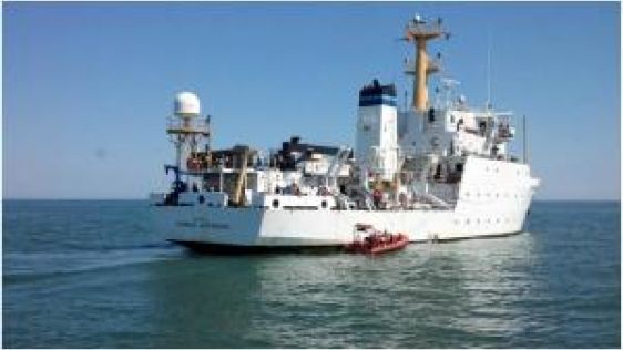
From 21 to 24 June 2013, a NOAA team from the Office of Coast Survey (OCS) and the Office of National Marine Sanctuaries (ONMS) conducted a joint mission to explore a shipwreck off...
Laser scanning and bathymetric side-scan sonar represent the cutting edge of environmental survey technology. Over the last few years, we have tested the integration of these two m...
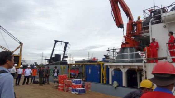
The Indonesian Association of Marine Survey Contractors launched a survey operation in early January 2015 to support the Indonesian National Agency for Search and Rescue. The opera...
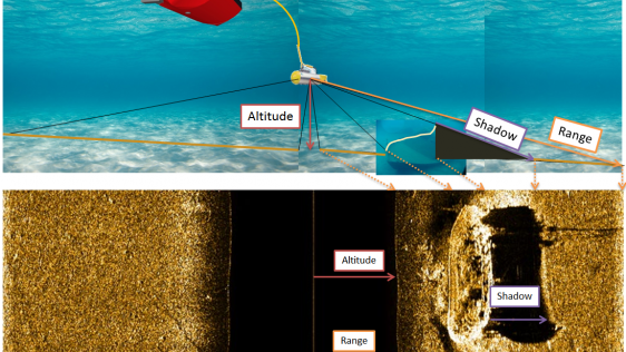
Although today’s multibeam echo sounders come with a backscatter option the more traditional Side-scan Sonar (SSS) still has many advantages when it comes to bottom imaging....
Side-scan sonar is well accepted as a tool for detection and visualisation of underwater objects and is widely used in support of safety of navigation surveys. Although side-scan s...

It was a rainy day at Woods Hole, Massachusetts, USA. The scenery reminds me of the Twin Peaks atmosphere. I am about to interview Mike Purcell, the man whose search team finally f...

Sonardyne is an organisastion at the forefront of acoustic, inertial, sonar and optical subsea technology development. It takes vision, a sustained focus on research and developmen...
Here we present the winning project of an industry-supported student research campaign, initiated in 2013 by Innomar Technologie GmbH, Germany. More than 25 European scientific ins...
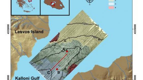
During a habitat mapping project at the Cyclades Islands (southern Aegean Sea - eastern Mediterranean Sea) which focused on the mapping of coralline algae, the shipwreck of HMHS Br...
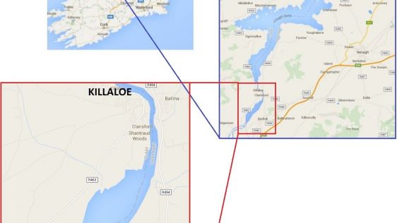
During the last week of a hydrographic survey of Lough Derg, Ireland’s third largest lake, the remnants of a preserved flooded landscape were unveiled beneath the surface wit...
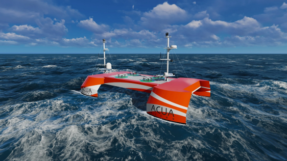
A consortium of USV and hydroacoustic tech firms, including ACUA Ocean, GeoAcoustics and Unmanned Survey Solutions (USS), has secured funding from the British Department for Enviro...
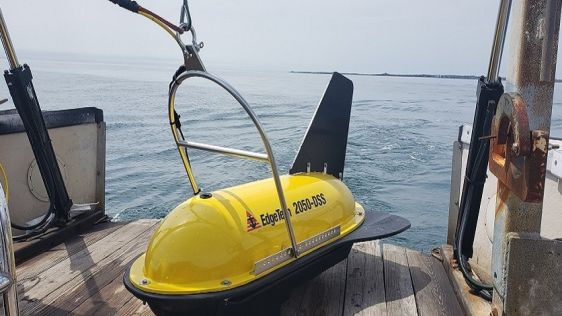
EdgeTech, a leader in high-resolution sonar imaging systems and underwater technology, has increased the standard depth rating to 3,000 metres on all new 2050 combined tri-frequenc...
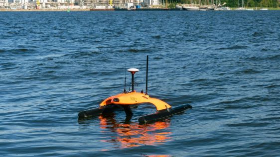
In the realm of advanced robotic solutions and underwater data networks, EvoLogics stands out as a pioneer. Renowned for its uncrewed surface vehicle the Sonobot 5, the company has...
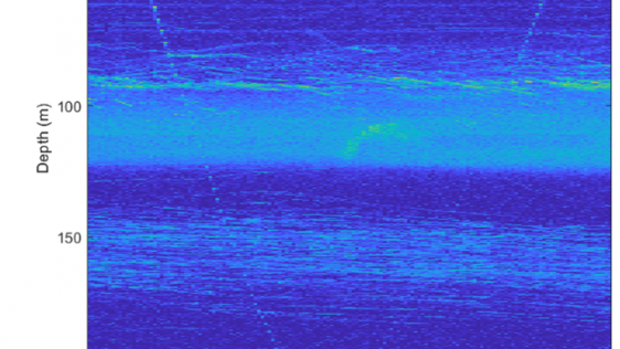
ASL Environmental Sciences has announced successful field trials of a new prototype split-beam sonar, which were conducted in the Saanich Inlet near the Institute of Ocean Sciences...
A prototype of the AZFP6-ice was deployed in the coastal waters approximately 40km east of the town of Nain, Labrador (Canada), an area used for Indigenous traditional hunting and...
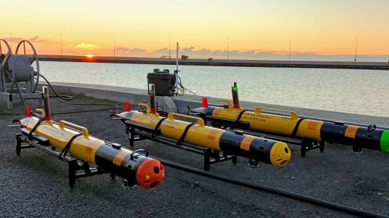
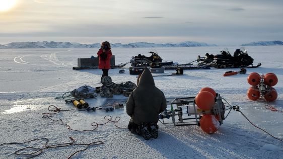
A first delivery of three small AUV units took place in January 2022 in the naval base of Frederikshavn, Denmark. This delivery is part of the recently signed framework agreement b...
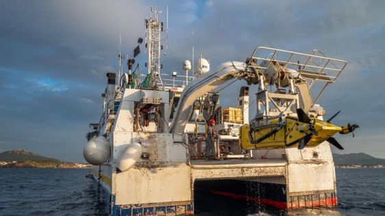
Ifremer, the French research institute for ocean science, has received its new synthetic aperture sonar (SAS) from iXblue. It will equip the institute’s new 6,000m-rated auto...
Active sonar suite and bottom navigation technology from Kongsberg Maritime has been selected for installation on Type 212CD class submarines for both the Norwegian and German navi...
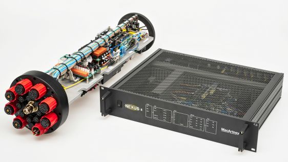
Underwater technology specialist MacArtney is launching the latest addition to the NEXUS multiplexer family at the biannual Ocean Business 2021 exhibition. Continuing a long tradit...

Given the Netherlands’ geographical location, it is unsurprising to find it has a long tradition of hydrography. The lowland, often below sea level, forms a delta where major...

Collaborating and coordinating are two very important tasks of EuroGOOS, the European Global Ocean Observing System, located in Brussels. The member organizations work together to...

By harnessing capabilities of advanced satellite technology and ever-evolving data analysis, satellite-based mapping (including satellite-derived bathymetry, SDB) offers an efficie...
In an era of great power competition, unmanned maritime systems (UMSs) have begun to take centre stage and are now on an accelerated development path for reasons that are clear. Li...
In the quest to unravel the mysteries beneath our planet’s water bodies, topobathymetric technologies emerge as a beacon of innovation. Among them, Lidar (light detection and...
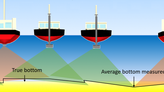
IHO standard S-44 is often used (or misused) to specify the quality of a hydrographic survey. While it is a useful tool, it is easy to misinterpret. One ‘misuse’ is to...
In a March 2023 blog, Microsoft founder, billionaire entrepreneur and philanthropist Bill Gates said: “The development of AI is as fundamental as the creation of the micropro...
When contemplating the replacement of a research and survey fleet, a collective effort is required to meticulously curate an optimal new fleet, considering factors such as ship typ...
How do you perceive prospects in the hydrographic surveying industry in 2024, compared to the past couple of years? When contemplating the hydrographic sector holistically, which a...
Follow Hydro International on Facebook, LinkedIn, Twitter or sign up for the newsletter! Don't miss the latest developments: join Hydro International!
 |  |  |  |
| 14.540 SUBSCRIBERS | 7.245 MEMBERS | 5.205 LIKES | 4.632 |
At Hydro International, we often receive permission requests to use our articles for republishing purposes. Get permission to reuse our content quickly and easily with PLS Permissions Request. Simply search for Hydro International and fill in the article you are looking for.
This site uses cookies. By continuing to use this website, you agree to our Cookies Policy. Agree
