Hydromagic Survey
Eye4Software Hydromagic Survey is a cost effective, easy to use hydrographic data acquisition and processing software package for Windows. The software has a sh...
Eye4Software B.V., based in the Netherlands, specializes in the development of GPS and GIS mapping software for Windows. Eye4Software started the development of Hydromagic after being asked by clients if it was not possible to develop a more cost-effective and user-friendly package for hydrographic surveys. The development of this software started in 2001 and since 2011 the Hydromagic software is used worldwide by all kinds of companies.
Currently, the software has over 1500 unique users, ranging from mining companies, water boards, dredging companies, surveying firms, departments of transportation and much more.
The software’s unique selling point is that it has the great advantage that it can be used without intensive training by people with as well as without hydrographic background. Our main vision is to keep the software as simple as possible so that customers can learn the basic skills within a single working day.
For more information about our company or the Hydromagic software, or in case you are interested in a dealership for your country, please visit our website or contact one of our many resellers around the world.
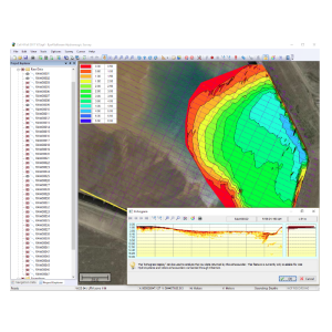
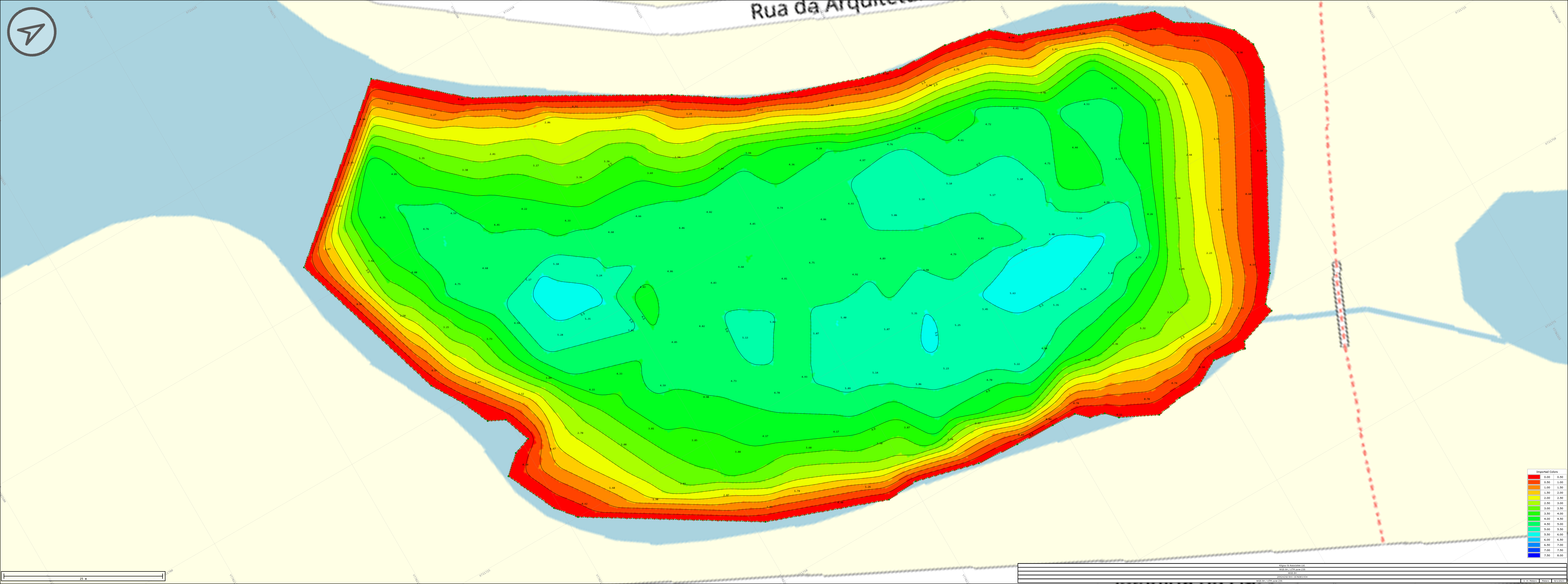
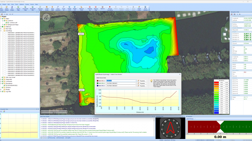
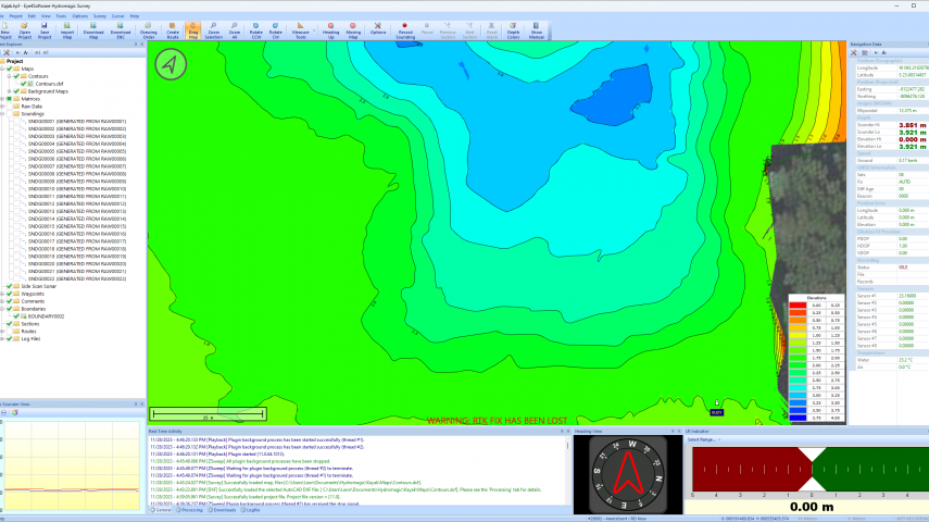
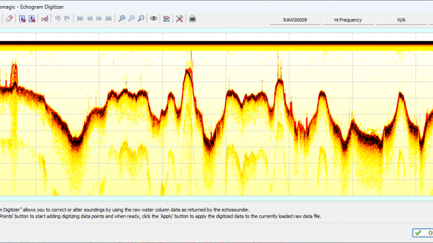
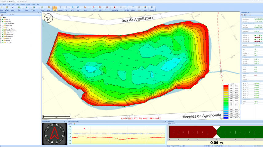
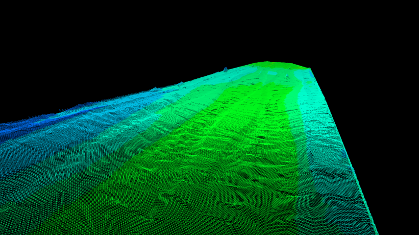
Eye4Software Hydromagic is a hydrographic survey package, which can be used to map areas using a GNSS receiver and echo sounder. You can use the software to import, view and edit your maps, display your position and to record depths (create soundings).
The software includes device drivers for almost any GNSS receiver and echo sounder around, and can be used on any desktop, laptop or tablet computer running Windows.
Applications:
Hydromagic is an affordable, easy to use software designed for:
Eye4Software Hydromagic Survey is a cost effective, easy to use hydrographic data acquisition and processing software package for Windows. The software has a sh...
This site uses cookies. By continuing to use this website, you agree to our Cookies Policy. Agree